The Photogrammetric Record 21(116): 342–354 (December 2006)
LOCAL ACCURACY MEASURES FOR
DIGITAL TERRAIN MODELS
Karl Kraus
Institute of Photogrammetry and Remote Sensing Vienna University of Technology, Austria
Wilfried Karel (wk@ipf.tuwien.ac.at)
Christian Briese (cb@ipf.tuwien.ac.at)
Gottfried Mandlburger (gm@ipf.tuwien.ac.at)
Christian Doppler Laboratory for ‘‘Spatial Data from Laser Scanning and Remote Sensing’’
at the Institute of Photogrammetry and Remote Sensing Vienna University of Technology,
Austria
Abstract
Airborne laser scanning and image matching can today form the basis for the
generation of digital terrain models (DTMs). In addition to the DTM, quality parameters are needed that describe the accuracy at a high level of detail, at best for every
interpolated DTM point. Furthermore, other parameters are of interest, for example, the
distance from each DTM point to the data point next to it. This paper presents a method
to derive accuracy measures from the original data and the DTM itself. Its application is
demonstrated with an example. The quality measures are suitable for informing users in
detail about DTM quality and warning them of weakly determined areas.
Keywords: accuracy, digital terrain model, laser scanning, precision, quality
Introduction
Digital terrain models (DTMs) form a fundamental data-set in many geographical
information systems (GIS). Unfortunately, the quality of these DTMs is rarely communicated
to GIS users (Wood and Fisher, 1993).
During the past decade, interest in DTM generation was stimulated through the
development of airborne laser scanning (ALS). In the process of DTM creation from ALS data,
the elimination of off-terrain points on buildings, trees and bushes is of crucial importance.
This removal is also described as filtering (Sithole and Vosselman, 2004). This may result in
large data voids of which users must be made aware.
In a similar way, matching procedures in digital stereo photogrammetry encounter
difficulties with off-terrain objects. Furthermore, it has to be considered that the point density
decreases significantly in poorly textured areas.
The best way of informing users about DTM quality is by means of accuracy measures.
Examples for global DTM accuracy measures can be found in Li (1993). However, global
Professor Karl Kraus died in Berlin on 5th April 2006 while this paper was still under review after revision.
An obituary is published elsewhere in this issue.
Ó 2006 The Authors. Journal Compilation Ó 2006 The Remote Sensing and Photogrammetry Society and Blackwell Publishing Ltd.
Blackwell Publishing Ltd. 9600 Garsington Road, Oxford OX4 2DQ, UK and 350 Main Street Malden, MA 02148, USA.
�The Photogrammetric Record
accuracy measures are not satisfactory as they provide only one parameter for a rather large
area. This is because, for derived quantities such as volumes, lines of equal slope or boundaries
of flood risk areas, the spatial variation of quality is needed. For example, a quality value may
be given for every point of the regular grid which frequently forms the output of a DTM
computation. At best, this grid is enhanced with structural information, leading to a hybrid
DTM. The advantages of a hybrid DTM over a DTM consisting only of a triangular irregular
network (TIN) have been published recently (Ackermann and Kraus, 2004).
The calculus for DTM generation is the interpolation. McCullagh (1988) compiled and
analysed all well-established methods of that period. The accuracy of every interpolated point
may be deduced by error propagation during the DTM generation process. In the theory of
least squares adjustment, this accuracy is called precision (Mikhail, 1976). However, the
precision derived this way does not help to increase the confidence of DTM users, because they
perceive these algorithms as ‘‘black boxes’’.
This paper presents a simple method for the estimation of the accuracy at every grid
point, which considers all influencing factors. On the demand of the DTM user these factors
can also be visualised. Thus this approach provides confidence to DTM users. It may also be
used to analyse existing DTMs. The following factors influence the accuracy of the
interpolated grid points:
(a)
(b)
(c)
(d)
the
the
the
the
number and alignment of the neighbouring original points, whereby
distance to the respective grid point is of special importance,
terrain curvature in the neighbourhood of the grid point,* and
accuracy in height of the original points.
These factors form the input of a simple interpolation method for the estimation of the
accuracy of a grid point. As stated above, in least squares theory this accuracy is called
precision. From the point of view of DTM users this term sounds unfamiliar as they are
accustomed to the term relative accuracy.
In order to obtain absolute accuracies, supplementary terms must be added to the relative
accuracies. These terms mainly stem from the remaining errors of the georeferencing which
precedes the DTM generation. In aerial photogrammetry, this is achieved through aerotriangulation, nowadays assisted by the global positioning system (GPS) and perhaps an
inertial measurement unit (IMU) (Jacobsen, 2004). In ALS, a related method is used (Kager,
2004). The absolute accuracy is computed using check points of a much better accuracy than
the DTM under investigation. The estimation of absolute accuracies, which frequently involves
costly field measurements, is not discussed in this paper. Instead, it is presumed that the
georeferencing is carried out with a high accuracy and a reliability such that the difference
between relative and absolute accuracy can be ignored.
In the following, it is assumed that both the DTM and the data employed for DTM
interpolation are available. Sophisticated databases provide both the original data and the DTM
(Warriner and Mandlburger, 2005). In the subsequent development of theory a DTM with hybrid
structure is assumed. However, in the example presented no structural information is available.
Approach for the Derivation of the Height Accuracy of Each Grid Point
For accuracy estimations, simple functional models can be used, even if more complex
functional models have been applied for DTM generation. As a simple and easily
*Curvature is related to the well-known spectral analysis, which is sometimes used for the global accuracy
estimation of DTMs (Frederiksen, 1980; Tempfli, 1980).
Ó 2006 The Authors. Journal Compilation Ó 2006 The Remote Sensing and Photogrammetry Society and Blackwell Publishing Ltd.
343
�Kraus et al. Local accuracy measures for digital terrain models
understandable interpolation method ‘‘moving least squares’’ (MLS) with a first order
polynomial (plane) was chosen.
By means of a tilted plane, the height ZG at grid point G can be computed as
Z G ¼ a0 þ a1 X þ a2 Y :
ð1Þ
Having chosen the origin of the X, Y coordinate system at grid point G (Fig. 1), equation
(1) becomes simpler:
ZG ¼ a0 :
ð2Þ
The coefficients a0, a1 and a2 can be computed in a least squares adjustment, using points
in the neighbourhood of grid point G (Fig. 1):
3 2
1 X1
v1
6 .. 7 6 .. ..
6 . 7 6. .
6 . 7¼6. .
4 .. 5 4 .. ..
1 Xn
vn
2
2 3
3
Y1
Z1
2 3
.. 7
a0
6 .. 7
. 7 4 5 6 . 7
� a1 � 6 . 7
.. 7
4 .. 5
. 5
a2
Zn
Yn
v ¼ A � x � 1:
ð3aÞ
ð3bÞ
The a priori weights pi applied to the observation equations of the adjustment are
pi ¼
1
1
¼
2
2
1 þ si =rai 1 þ �s2i
ð4Þ
where si is the distance from the grid point to the original point and rai is the radius of
curvature of the DTM at the original point towards the grid point.
The weight pi of an original point will be greatest when it is near to the location of an
interpolated grid point and diminishes to zero with increasing distance (McCullagh, 1988).
This threshold controls the selection of points that participate in the interpolation. Additionally
breaklines should be considered as barriers in the selection of original points. This way, the
density and alignment of original points in the neighbourhood of the respective grid point are
considered. Furthermore, equation (4) indicates that the distance si is normalised with the
Z
G
Y
X
Fig. 1. Interpolation of a tilted plane using six neighbouring original points.
344
Ó 2006 The Authors. Journal Compilation Ó 2006 The Remote Sensing and Photogrammetry Society and Blackwell Publishing Ltd.
�The Photogrammetric Record
radius of curvature rai, which is computed using the DTM at the original point in the direction
ai towards the grid point G. Thus
si
�si ¼ :
ð5Þ
rai
Through this normalisation, original points with a large radius of curvature tend to affect
the result more than those with a small radius.
The weights pi in equation (4) are arranged in a diagonal matrix Pll. The authors are not
interested in the interpolation result ZG (equation (1) or (2), respectively), but only in an
estimation of the height accuracy of the grid point G, which is named r^DTM . This r^DTM can be
calculated as follows:
2 P
3
P
P
p P pX P pY
P
AT Pll A ¼ 4 P pX P pX 2 P pXY 5 ¼ N:
ð6Þ
pY
pXY
pY 2
The a posteriori weight coefficient qa0 for the unknown a0 is
�P
�
� pX 2 P pXY �
�P
�
P
� pXY
pY 2 �
qa0 ¼
:
jNj
ð7Þ
The spatial variation of the weight coefficient qa0 depends on the following factors:
(a) the DTM curvature through the weights pi,
(b) the alignment of the original points and the distances between them and the respective
grid point through the weights pi and through their X, Y coordinates in equations (6)
and (7) (if the neighbouring original points almost form a straight line and the grid
point is located aside, then the weight coefficient qa0 becomes very large), and
(c) the number of original points that are selected using the threshold stated above,
through the summations in equations (6) and (7).
With an estimation for the reference standard deviation r^0 , which will be described in the
following section, the accuracy r^DTM of the grid points is computed as
pffiffiffiffiffiffi
ð8Þ
r^DTM ¼ r^0 qa0 :
Representative Accuracy of the Original Points
The theory of least squares adjustment applied to the moving tilted plane estimates the
variance of the observation with unit weight, r^20 , as
r^20 ¼
vT Pll v
n�u
ð9Þ
where v is the vector of residuals (equation (3)), Pll is the diagonal matrix of the weights
(equation (4)), n is the number of original points participating in the adjustment of the
tilted plane and u is the number of unknowns, in this case: u ¼ 3.
In place of the residuals vi of the least squares adjustment of the tilted plane, the
discrepancies di between the original points and the DTM to be evaluated (Fig. 2) are used.
Ó 2006 The Authors. Journal Compilation Ó 2006 The Remote Sensing and Photogrammetry Society and Blackwell Publishing Ltd.
345
�Kraus et al. Local accuracy measures for digital terrain models
di
M
DT
G
ce
rfa
su
Si
ZG
(X,Y )
Fig. 2. Calculation of the height accuracy of original points in the neighbourhood of a grid point G (di are the
discrepancies, si are the distances between the original points and the grid point G).
This is because the discrepancies di better represent the errors of the original points with
respect to the DTM than do the residuals vi.
The reference standard deviation derived from the discrepancies di is denoted as r^0;d . It is
computed as
sffiffiffiffiffiffiffiffiffiffiffiffiffiffi
dT Pll d
ð10Þ
r^0;d ¼
n�u
where d is the vector of discrepancies (Fig. 2), Pll is the diagonal matrix of the weights
(equation (4)), n is the number of original points participating in the adjustment and u is the
number of unknowns, in this case: u ¼ 0.
The discrepancies are calculated using the points employed for DTM interpolation, thus
without the eliminated points on buildings, trees and bushes. They are influenced by the
calculus used for DTM interpolation, and by the performance of the filtering method used to
eliminate the outliers (such as points on bushes in ALS data).
The reference standard deviation r^0;d (equation (10)) varies from grid point to grid point.
It should stay greater than a certain threshold. This threshold can be estimated through the
specifications of the measurement device that was employed for data capture. Data points from
an airborne laser scanner, for instance, have an accuracy of about 5 cm, if high quality devices
are used and if advanced georeferencing is applied (Kager, 2004). In general, the accuracy of
measurement of stereo photogrammetry is worse and depends mainly on the flying height and
the camera type (Kraus, 2000).
Before the presentation of an example for the spatial variation of the accuracy of original
points r^0;d , the calculation of curvature and the alignment analysis of the original points will be
illustrated.
Curvature
DTM accuracy is influenced remarkably by terrain curvature. Curvature is regarded as
1/rai in equation (4). The terrain curvature is computed using the DTM. Although wellestablished GIS routines are applied, some details need to be stated. The curvatures along the
grid lines are calculated at each grid point. In doing so, the breaklines integrated into a hybrid
DTM (Ackermann and Kraus, 2004) must be considered, as denoted in Fig. 3. Consequently,
the minimum and maximum curvatures can be derived at each grid point. Using Dupin’s
Indicatrix, curvatures or radii of curvature rai can be computed for arbitrary directions ai. The
radius of curvature rai at a certain data point is computed for the direction to a usually rather
346
Ó 2006 The Authors. Journal Compilation Ó 2006 The Remote Sensing and Photogrammetry Society and Blackwell Publishing Ltd.
�The Photogrammetric Record
Grid Point
G
Original Breakline Point
Grid Intersection Point
Fig. 3. Computation of curvature at grid point G. Grid points and grid intersection points of breaklines that are
used for the computation are coloured black.
distant grid point. As the original points rarely coincide with the grid points, the curvature at a
data point has to be interpolated from the four surrounding grid points of the respective cell.
There is plenty of literature about differential geometry, for example, Kreyszig (1964) or
Novikov and Fomenko (1990). The application of this theory to the DTM can be found in
Briese (2004) and Gajski (2005).
Arrangement and Density of Original Data Points
The accuracy of a DTM is strongly influenced by point density. For the visualisation of
point density, the following method is preferred: an analysing grid with cell area A is laid over
the area of interest. Usually, A is chosen to be larger than the cell area of the DTM grid. Using
the number ni of original points in each cell, the point density n�i ¼ ni =A can be computed.
More complex than the computation of point density is the modelling of the arrangement
of original points. The distance from the data points to each grid point, or their influence on
grid point heights, respectively, is of special interest. For this purpose, the Chamfer function
(Borgefors, 1986) may be applied. It facilitates the measurement of distances smi between each
grid point and its nearest original point with high efficiency (Fig. 4).
Fig. 4. Distances smi between each grid point (grey) of the DTM and its nearest data point (black) in the original
data-set.
Ó 2006 The Authors. Journal Compilation Ó 2006 The Remote Sensing and Photogrammetry Society and Blackwell Publishing Ltd.
347
�Kraus et al. Local accuracy measures for digital terrain models
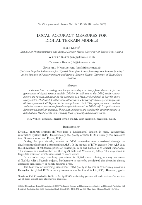
Fig. 5. Shaded DSM, derived from airborne laser scanner data.
Example
Fig. 5 shows the shaded digital surface model (DSM) computed with a set of airborne
laser scanner data that originates from EuroSDR (IPF, 2005). Using the method described by
Kraus and Pfeifer (1998), a DTM with a grid width of 1 m was deduced from the data. The
mathematical background of this method is the least squares interpolation, which is equivalent
to simple kriging (Kraus, 1998). For the processing of ALS data, the least squares interpolation
was adapted, resulting in a robust estimator with an eccentric and asymmetric weight function.
Using the robust estimator, points on buildings and high vegetation are eliminated (filtered
out). Details can be found in the literature mentioned above (Kraus and Pfeifer, 1998; Briese
et al., 2002).
Fig. 6 illustrates the DTM in a shaded view together with contour lines. This already
existing DTM is evaluated using the approach of this paper. Before the presentation of the
final, spatially varying DTM accuracy r^DTM , some intermediate results and diverse influencing
factors are visualised.
Fig. 6. Shaded DTM, together with contour lines (2 m interval), derived from airborne laser scanner data.
348
Ó 2006 The Authors. Journal Compilation Ó 2006 The Remote Sensing and Photogrammetry Society and Blackwell Publishing Ltd.
�The Photogrammetric Record
Fig. 7. Original points that form the basis of DTM interpolation (Fig. 6).
The first of these figures (Fig. 7) shows the original points that were employed for the
interpolation of the DTM (Fig. 6). Areas with large data voids are distinguishable. These areas
originate on the one hand from the missing overlap of the airborne laser scanner strips. On the
other hand, they stem from zones where many points on high vegetation and on buildings have
been eliminated in the filtering process (compare Fig. 5 and Fig. 7).
The next visualisation is the point density �
ni (Fig. 8). It also reflects the holes in the
original data that originate from the filtering process and the missing overlap of the airborne
laser scanner strips. These holes must be quantified. In order to do so, the distances between the
grid points and their nearest data point smi are computed (see Fig. 9). These distances can be
confronted with an adequately chosen threshold (in Fig. 9, its value amounts to seven times the
DTM grid width, or 7 m). Grid points that hold too large minimum distances are classified as
unusable. This information is very important for the DTM user. Unaffected by large data voids,
powerful software packages provide DTMs without gaps (see Fig. 6). For many applications,
for example, the modelling of the boundary of a flood risk area, a closed DTM is required.
However, the result is unusable if the boundary proves to lie on a data void. In this case, that
part of the boundary must not be passed on to users such as local governments or property
owners.
Fig. 8. Point density n�i of the original points (Fig. 7), computed with a cell size A of 100 m2. Cells that do not
contain any point are coloured black.
Ó 2006 The Authors. Journal Compilation Ó 2006 The Remote Sensing and Photogrammetry Society and Blackwell Publishing Ltd.
349
�Kraus et al. Local accuracy measures for digital terrain models
Fig. 9. Minimum distances smi between each grid point and its nearest data point (Fig. 7). Grid points where the
threshold of seven times the DTM grid width (7 m) is exceeded are marked in red.
A further visualisation, namely, terrain curvature, appears to be less interesting for DTM
users, but still of importance for analysts. In the approach of this paper, the terrain curvature
1/rai is used for weighting (equation (4)). In Fig. 10, the maximum main curvature at each grid
point is presented on a scale from )1Æ0 to 1Æ0 m)1. Obviously, DTM curvature is a good
indication of terrain relief. However, DTM curvature is also very sensitive to DTM artefacts.
Wood and Fisher (1993) have investigated the spatial variation of DTM accuracy, using GIS
operators that employ neighbouring grid points (similar to the computation of DTM curvature
in this paper). However, the focus of that article is set on the visualisation of DTMs derived
from contour lines using four different interpolation methods. Unlike in the present paper,
quantitative accuracy measures are not a central issue.
The next important visualisation of the presented approach displays the accuracy of the
original points, derived from their discrepancies to the DTM. The reference standard deviation
defined in equation (10) is outlined in Fig. 11. The value of r^0;d varies between ±5 and ±40 cm.
The lower value should not be smaller than the a priori known accuracy addressed above. In
the present example, this lower boundary amounts to 5 cm. Red areas denote zones where no
Fig. 10. Maximum main curvature at the grid points of the DTM from Fig. 6.
350
Ó 2006 The Authors. Journal Compilation Ó 2006 The Remote Sensing and Photogrammetry Society and Blackwell Publishing Ltd.
�The Photogrammetric Record
Fig. 11. Height accuracy r^0;d of original points (Fig. 7) in the neighbourhood of grid points of the DTM. Areas
where smi exceeds the user-defined threshold of 7 m (Fig. 9) are coloured red.
Fig. 12. Cofactor in height of the adjustment of the tilted plane.
original points surround the grid points. These areas were excluded with a threshold of 7 m for
the minimum distances smi.
In addition to the reference standard deviation r^0;d , the weight coefficient qa0 (equation
(7)) is needed for the computation of the DTM accuracy r^DTM (equation (8)). For the present
example, the weight coefficients are shown in Fig. 12. Red areas once more denote zones
where there are no original points near the grid points. These areas were excluded using a
threshold of 7 m for the minimum distances smi. The weight coefficients vary between 0Æ3 and
30. If the weight coefficient qa0 equals 1, then the height of the DTM grid point has the
accuracy of the neighbouring original points that is expressed by the reference standard
deviation r^0;d (Fig. 11). If qa0 is greater than 1, then r^DTM is worse than the reference standard
deviation r^0;d . If qa0 is smaller than 1, which should be aimed at, then r^DTM is better than the
reference standard deviation r^0;d .
The last but most important visualisation is the spatial variation of the height accuracy of
the DTM, computed with equation (8), employing the reference standard deviation r^0;d
(Fig. 11) and the weight coefficients qa0 (Fig. 12). Fig. 13 shows the height accuracy r^DTM of
Ó 2006 The Authors. Journal Compilation Ó 2006 The Remote Sensing and Photogrammetry Society and Blackwell Publishing Ltd.
351
�Kraus et al. Local accuracy measures for digital terrain models
Fig. 13. Standard deviation in height of the DTM.
the DTM. Areas that have been excluded using the minimum distances smi are marked as
unusable in red. The height accuracy r^DTM varies between ±0Æ01 and ±2Æ00 m.
Recommendations and Outlook
Where the original points used for the interpolation of the DTM are available, the spatial
variation of DTM quality in height can be derived. Fig. 13 is such a quality layer. Unusable
areas should be marked in the visualisation—for example, in red. In the future, this quality
layer should be provided in addition to the DTM. Such information can be generated for both
new and existing DTMs. GIS users will welcome its application.
Moreover, the software should allow interested GIS users to view the following
information:
(a)
(b)
(c)
(d)
(e)
point density (Fig. 8),
minimum distances smi between each grid point and its nearest data point (Fig. 9),
maximum main curvature (Fig. 10),
reference standard deviation in height r^0;d computed using equation (10) (Fig. 11),
weight coefficients qa0 computed using equation (7) (Fig. 12).
These additional visualisations are of special interest to DTM experts who analyse DTMs.
The DTM theory presented in this paper will be tested with diverse data-sets in the future.
A test series with both ALS and photogrammetric data has already been evaluated. The results
will soon be released in a EuroSDR publication (Karel and Kraus, 2007). These test series will
also provide feedback for the choice of adequate thresholds, and for the enhancement of
software performance (for example, not computing the standard deviation r^DTM at every grid
point, but only at every fourth).
As stated above, this paper is focused on relative accuracy. It is presumed that the data is
free from systematic errors. Whether this assumption is admissible may be tested using
external check points with an accuracy superior to that of the DTM. However, the analysis of
zones of overlapping ALS strips also shows up systematic errors, see Kager (2004) or Maas
(2002). Presumably, additional processes will be investigated in the near future that allow for
the estimation of absolute accuracies on the basis of relative ones.
Concluding, it has to be mentioned that the presented quality measures focus on height
accuracies. In future research, planimetry will also be considered.
352
Ó 2006 The Authors. Journal Compilation Ó 2006 The Remote Sensing and Photogrammetry Society and Blackwell Publishing Ltd.
�The Photogrammetric Record
references
Ackermann, F. and Kraus, K., 2004. Grid based digital terrain models. Geo Informatics, 7(6), 28–31.
Borgefors, G., 1986. Distance transformations in digital images. Computer Vision, Graphics, and Image
Processing, 34(3): 344–371.
Briese, C., 2004. Three-dimensional modelling of breaklines from airborne laser scanner data. International
Archives of the Photogrammetry, Remote Sensing and Spatial Information Sciences, 35(B3): 1097–1102.
Briese, C., Pfeifer, N. and Dorninger, P., 2002. Applications of the robust interpolation for DTM determination. International Archives of the Photogrammetry, Remote Sensing and Spatial Information Sciences,
34(3A): 55–61.
Frederiksen, P., 1980. Terrain analysis and accuracy prediction by means of the Fourier transformation. International Archives of Photogrammetry and Remote Sensing, 23(4): 284–293.
Gajski, D., 2005. Rasterbasierte Geländeoberflächenanalysen. Dissertation, Vienna University of Technology,
Vienna, Austria. 167 pages.
IPF, 2005. http://www.ipf.tuwien.ac.at/eurosdr/download.htm [Accessed: 19th September 2005].
Jacobsen, K., 2004. Direct/integrated sensor orientation—pros and cons. International Archives of the Photogrammetry, Remote Sensing and Spatial Information Sciences, 35(B3): 829–835.
Kager, H., 2004. Discrepancies between overlapping laser scanner strips—simultaneous fitting of aerial laser
scanner strips. International Archives of the Photogrammetry, Remote Sensing and Spatial Information
Sciences, 35(B1): 555–560.
Karel, W. and Kraus, K., 2007. Quality parameters of digital terrain models. Seminar on Automatic Quality
Control of Digital Terrain Models, Aalborg, Denmark (Ed. J. Höhle). EuroSDR Publication (in press).
Kraus, K., 1998. Interpolation nach kleinsten Quadraten versus Krige-Schätzer. Österreichische Zeitschrift für
Vermessung und Geoinformation, 86(1): 45–48.
Kraus, K., 2000. Photogrammetry. Volume 1: Fundamentals and Standard Processes. Fourth edition. Dümmler,
Bonn, Germany. 397 pages.
Kraus, K. and Pfeifer, N., 1998. Determination of terrain models in wooded areas with airborne laser scanner
data. ISPRS Journal of Photogrammetry and Remote Sensing, 53(4): 193–203.
Kreyszig, E., 1964. Differential Geometry. Revised edition. University of Toronto Press, Toronto. 377 pages.
Li, Z., 1993. Theoretical models of the accuracy of digital terrain models: an evaluation and some observations.
Photogrammetric Record, 14(82): 651–660.
Maas, H.-G., 2002. Methods for measuring height and planimetry discrepancies in airborne laserscanner data.
Photogrammetric Engineering & Remote Sensing, 68(9): 933–940.
McCullagh, M., 1988. Terrain and surface modelling systems: theory and practice. Photogrammetric Record,
12(72): 747–779.
Mikhail, E. M., 1976. Observations and Least Squares. With contributions by F. Ackermann. IEP, New York.
497 pages.
Novikov, S. P. and Fomenko, A. T., 1990. Basic Elements of Differential Geometry and Topology. Kluwer,
Dordrecht. 490 pages.
Sithole, G. and Vosselman, G., 2004. Experimental comparison of filter algorithms for bare-earth extraction
from airborne laser scanning point clouds. ISPRS Journal of Photogrammetry and Remote Sensing, 59(1/2):
85–101.
Tempfli, K., 1980. Spectral analysis of terrain relief for the accuracy estimation of digital terrain models. I.T.C.
Journal, 1980–3:478–510.
Warriner, T. and Mandlburger, G., 2005. Generating a new high resolution DTM product from various data
sources. Photogrammetric Week 05, Stuttgart, Germany. 339 pages: 197–206.
Wood, J. and Fisher, P., 1993. Assessing interpolation accuracy in elevation models. IEEE Computer Graphics
and Applications, 13(2): 48–56.
Résumé
Pour établir des modèles numériques du terrain (MNT) on peut considérer qu’on
dispose actuellement, comme techniques de base, du scannage par laser aéroporté et
de l’appariement d’images. Accompagnant le MNT, il est souhaitable d’avoir en
supplément des paramètres de qualité qui en fournissent la précision avec un grand
niveau de détail, au moins en chacun des points du MNT obtenus par interpolation.
D’autres paramètres sont également intéressants, comme par exemple la distance de
Ó 2006 The Authors. Journal Compilation Ó 2006 The Remote Sensing and Photogrammetry Society and Blackwell Publishing Ltd.
353
�Kraus et al. Local accuracy measures for digital terrain models
chaque point du MNT au point de base voisin. On décrit dans cet article une méthode
permettant de déterminer la précision à partir des données-source et du MNT
lui-même. Un exemple vient en appui de cette méthode. La connaissance de la
qualité d’un MNT est une information très utile pour les utilisateurs de ce MNT et qui
les met en garde dans les zones où celui-ci présente des faiblesses dans sa formation.
Zusammenfassung
Flugzeuggetragenes Laserscanning und automatische Bildzuordnung dienen
heutzutage als Grundlage für die Erstellung von digitalen Geländemodellen (DGM).
Zusätzlich zum DGM werden Qualitätsparameter benötigt, die seine Genauigkeit
sehr detailliert, am besten für jeden interpolierten DGM-Punkt, beschreiben.
Außerdem sind weitere Parameter hilfreich, zum Beispiel die Distanz von jedem
Gitterpunkt zum nächstgelegenen Datenpunkt. Dieser Artikel beschreibt eine
Methode, um aus den Originaldaten und dem zu beurteilenden DGM seine
Genauigkeit abzuleiten. Die Anwendung der Methode wird an einem Beispiel
veranschaulicht. Mit Hilfe der präsentierten Qualitätsparameter können Benutzer
sehr genau über die DGM-Qualität informiert und vor schlecht bestimmten Bereichen
gewarnt werden.
Resumen
En la actualidad la altimetrı́a de barrido láser y la correlación automática de
imágenes son la base para la obtención de modelos digitales de elevación (MDE).
Además del MDE, se necesitan parámetros de calidad que describan detalladamente
su exactitud, a ser posible en cada punto interpolado del MDE. Además, hay otros
parámetros de interés, por ejemplo la distancia entre cada punto del modelo y el
punto original más próximo. Este artı́culo describe un método para obtener medidas
de calidad de los datos originales y del propio MDE. Su aplicación se demuestra con
un ejemplo. Mediante dichos parámetros de calidad se puede informar a los usuarios
acerca de la calidad del MDE y advertirles acerca de las áreas peor estimadas.
354
Ó 2006 The Authors. Journal Compilation Ó 2006 The Remote Sensing and Photogrammetry Society and Blackwell Publishing Ltd.
�
 Wilfried Karel