RESEARCH ARTICLE
Agricultural land use among mestizo colonist
and indigenous populations: Contrasting
patterns in the Amazon
Cristian Vasco1*, Richard Bilsborrow2, Bolier Torres3☯, Verena Griess4☯
a1111111111
a1111111111
a1111111111
a1111111111
a1111111111
1 Facultad de Ciencias Agrı́colas, Universidad Central del Ecuador, Quito, Ecuador, 2 Carolina Population
Center, University of North Carolina at Chapel Hill, Chapel Hill, United States of America, 3 Universidad
Estatal Amazónica, Puyo, Ecuador, 4 Department of Forest Resources Management, the University of British
Columbia, Vancouver, Canada
☯ These authors contributed equally to this work.
* clvasco@uce.edu.ec
Abstract
OPEN ACCESS
Citation: Vasco C, Bilsborrow R, Torres B, Griess V
(2018) Agricultural land use among mestizo
colonist and indigenous populations: Contrasting
patterns in the Amazon. PLoS ONE 13(7):
e0199518. https://doi.org/10.1371/journal.
pone.0199518
Editor: Margaret Holland, University of Maryland
Baltimore County, UNITED STATES
Received: October 26, 2017
This paper compares land use patterns of mestizo colonists and indigenous populations in
the central Ecuadorian Amazon, based on data from a household survey covering mestizo
colonist, Kichwa and Shuar households. As expected, colonists mostly engage in commercial agriculture and cattle ranching, but there are substantial differences in land use patterns
between the Shuar and the Kichwa. The Shuar engage in cash cropping and cattle ranching,
and on average, devote even more land to agricultural uses than mestizo colonists in this
sample. In contrast, the Kichwa engage more in subsistence crop production and less in
commercial agriculture. Such different patterns appear related to local conditions, earlier
migratory and settlement patterns, and the level of exposure to markets. The implications of
this for policy are explored in the conclusions.
Accepted: June 9, 2018
Published: July 5, 2018
Copyright: © 2018 Vasco et al. This is an open
access article distributed under the terms of the
Creative Commons Attribution License, which
permits unrestricted use, distribution, and
reproduction in any medium, provided the original
author and source are credited.
Data Availability Statement: All relevant data are
within the paper and its Supporting Information
files.
Funding: This paper was based upon work funded
by Universidad Estatal Amazónica at Puyo, Ecuador
(Award number: AMB-001-013 (https://www.uea.
edu.ec/). The funder had no role in study design,
data collection and analysis, decision to publish, or
preparation of the manuscript.
Competing interests: The authors have declared
that no competing interests exist.
Introduction
As with most environmental problems, deforestation is closely linked to human activities,
especially agriculture [1, 2]. In fact, agricultural expansion is widely identified as the main
proximate driver of deforestation in tropical forests and is also associated with a number of
other environmental problems, including desertification, soil erosion, climate change and biodiversity loss [3, 4]. Therefore, understanding the interactions between humans and the environment in the context of the socioeconomic drivers of land cover change is important for the
conservation of forests as well as the other ecosystem services it provides.
Much has been written on the determinants of land use decisions in the tropics. The
literature makes a clear distinction between the land use patterns of migrant colonists and
those of the traditional inhabitants. Colonists are generally reported to use unsustainable
production systems featured by extensive clearing of land with continuous incorporation
over time of additional forest areas into agricultural production [5, 6]. This contrasts with
a common belief that indigenous populations are associated with sustainable agricultural
PLOS ONE | https://doi.org/10.1371/journal.pone.0199518 July 5, 2018
1 / 16
�Agricultural land use colonists indigenous
practices (long fallow, in the Boserup [7] sense) with little environmental impact and hence
compatible with resource conservation [8, 9]. Nevertheless, several studies [10–15] show
that indigenous peoples sometimes also engage in unsustainable practices, including cash
cropping, cattle ranching and timber logging when in contact with the market economy.
Such changes are a matter of concern, given the importance of large indigenous territories
for conservation in Ecuador and throughout the Amazon basin [16, 17], the high rates of
deforestation in colonist lands [18], the high rates of population growth in indigenous communities [12, 19], and the accelerated integration of indigenous peoples into the market
economy [20].
In the case of the Amazon rainforest, one of the world’s biodiversity hotspots [21, 22], few
studies have compared land use patterns of indigenous and colonist migrants. In the Peruvian Amazon, Hvalkof [23] found that the Shumahuani people keep most of their lands in
forest and carry out sustainable management practices in contrast to local colonists who
clear forest to establish pastures. In the Brazilian Amazon, van Vliet et al. [24] found that
slash and burn cultivation system is practiced mainly by colonists while the more environmentally friendly shifting cultivation system is principally used by indigenous peoples. Nevertheless, the authors note that this difference is blurred due to increased integration of
indigenous peoples into the market economy. Also in the Brazilian Amazon, Caviglia-Harris
and Sills [25] found no differences in land use patterns of colonists and “traditional” farmers.
The authors concluded that socioeconomic conditions matter more than cultural background when explaining land use.
Finally, several studies have been conducted on the Ecuadorian Amazon, generally concluding that indigenous practices have a much lower environmental impact than colonists [10,
26, 27]. Thus combining satellite imagery and household survey data for the northern Ecuadorian Amazon, Lu et al. [27] found that colonists managed substantially larger agricultural
areas (twice the area in crops and five times the area in pasture) than indigenous populations,
even though the latter had access to at least four times the area per household. The authors
note, however, that there are substantial differences among indigenous communities, with
some ethnic groups engaging in cattle ranching and commercial agriculture more than others.
Among other studies, Rudel et al. [10] found that the Shuar–an indigenous group from the
southern Ecuadorian Amazon- adopt more sustainable agricultural systems (perennial cash
crops such as cacao and coffee) in contrast to colonists who engage primarily in cattle ranching. Similarly Rudel et al. [26] note that during the 1980s, colonist migrants and the Shuar
responded in different ways to a pest infestation affecting a local cash crop naranjilla–a citrus
fruit which accounted for most of the income of both ethnic groups: Colonists responded by
converting infested fields to pasture, while the Shuar allowed secondary forest to develop in
former naranjilla fields and engaged in the cultivation of customary garden crops and small
areas of cash crops (coffee and cacao). But do these patterns still apply in a context of high
rates of population growth and urbanization [12, 19], scarcity of land [28], increased off-farm
opportunities [29], and increased integration of indigenous peoples into the market economy
[20]?
This research addresses this and related questions using data from a household survey covering both colonist and indigenous (Kichwa and Shuar) households in the province of Pastaza,
in the central Ecuadorian Amazon. Following this introduction, the rest of this paper is structured as follows: the next section describes the socio-economic-cultural context of the migrant
colonists, the Kichwa and the Shuar in the Ecuadorian Amazon. Then the theoretical framework is presented, data collection explained and the statistical estimation methodology
described. Finally, the results are presented and discussed, followed by concluding remarks
and policy implications.
PLOS ONE | https://doi.org/10.1371/journal.pone.0199518 July 5, 2018
2 / 16
�Agricultural land use colonists indigenous
The study context: Migrant colonists, Kichwa and Shuar in the
Ecuadorian Amazon, focusing on Pastaza province
In the 1960s, following the enactment of Ecuador’s major land reform legislation in 1964 and
the first discovery of significant oil reserves in the northern Amazon in 1967, roads were constructed by oil companies to lay pipelines to pump petroleum from the Amazon to the Pacific
port of Esmeraldas for export. This led to a large migration of mostly poor farmers with little
or no land, principally from the Sierra or highlands region, to the Amazon in search of land.
Although in the case of Ecuador -in contrast to Brazil, for example [30], this was a process of
spontaneous migration [31], it was also encouraged by the Government in an effort to occupy
and incorporate the “empty lands” of the Amazon into agricultural production [26, 32]. Such
migrants brought with them knowledge of production systems characterized by low technology, high dependence on family labor, cattle ranching, and exploitation of natural resources
[5]. In fact, clearing a portion of forest and providing evidence of agricultural use was a precondition to claim legal rights over the plot [6], although this was never enforced. Since most
soils in the Ecuadorian Amazon are not suitable for agriculture [33, 34], colonists tend to compensate for the common low fertility of Amazonian soils by clearing more land for cultivation.
As a consequence, deforestation rates in the Ecuadorian Amazon rank among the highest in
the world [35]. Pressures on land have intensified in recent decades as a result of high rates of
population growth of colonists and the continuous process of land subdivision [30]. Furthermore, the Ecuadorian Amazon may be considered essentially a closed frontier, with little available unused land left, since large areas have been either appropriated by the State to create
three large national parks or allocated to indigenous peoples via communal land titles.
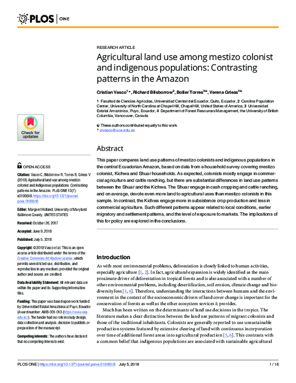
In terms of the main land use practices of the three study populations in Pastaza, first, mestizo colonists number about 46,000 and are settled in the westernmost part of the province,
near Puyo, the provincial capital (see Fig 1). They specialize in cash crop production (naranjilla, cacao and sugar cane) as well as some cattle ranching [36]. In contrast, the lowland
Kichwa are the most numerous indigenous group in both the Ecuadorian Amazon overall and
in the province of Pastaza, with approximate populations of about 125,000 and 18,000, respectively [37]. The Kichwa of Pastaza derive from the fusion of several Amazon peoples (Shuar,
Achuar, Zaparos and Andoas) as well as highland Kichwa who migrated to the Amazon to
escape Spanish colonial oppression [38, 39]. Some scholars [39, 40] describe how the Kichwa
obtain their livelihoods principally from subsistence farming (cassava–locally known as
“yuca”, plantain, taro, and maize), the collection of forest products, hunting and fishing. Nevertheless, others report that some Kichwa have adopted colonist-style agricultural systems and
nowadays also engage in commercial agriculture, cattle ranching, timber logging and off-farm
wage employment in areas close to roads and urban centers [29, 41]. Although the Kichwa
control extensive areas of land (approximately 1,400,000 hectares) in Pastaza under common
property land entitlement regimes and with population densities generally low, pressures on
land do exist in some communities where population growth is high and agricultural land is
concentrated along a main river or road.
The so-called “jı́baros” or Shuar are the traditional inhabitants of the tropical forests of
southeastern Ecuador, numbering about 78,000 persons, 80% in the province of Morona Santiago [37]. During the 1960s, in response to increasing colonist encroachment, they sought
property rights to extensive areas of land in Morona Santiago with the support of Catholic
NGOs. In order to support their claims, they replicated the colonist strategy of clearing areas
of forest, planting pasture and establishing small herds of cattle [10]. They did this not only in
their home territories but also in provinces to the north where some migrated to establish
communities along roads. There they tended to adopt colonist’s livelihood activities, including
PLOS ONE | https://doi.org/10.1371/journal.pone.0199518 July 5, 2018
3 / 16
�Agricultural land use colonists indigenous
Fig 1. The study area and communities in Pastaza province, Ecuadorian Amazon. Reprinted from [49] under a CC BY license, with permission from
Universidad Estatal Amazónica, original copyright 2017.
https://doi.org/10.1371/journal.pone.0199518.g001
commercial agriculture, cattle raising and off-farm employment [42]. The Shuar of Pastaza
number about 5,600 and are mainly concentrated along the road going south from Puyo
towards Morona Santiago (see Fig 1), their province of origin [37]. The Shuar of Pastaza hold
common property rights over about 200,000 ha of land [36], with population densities higher
than those in Kichwa communities [43], which may be associated with higher deforestation.
Theoretical framework
The rural livelihood model and the microeconomic model of the agricultural household [44,
45] together provide a suitable point of departure to analyze household decisions regarding
land use and the factors that affect it. The model of the agricultural household, as expanded by
the livelihoods framework, hypotheses that a household makes resource allocation decisions
based on the endowments of natural capital (land, water, trees), physical capital (irrigation
canals, agricultural machinery and implements, roads), human capital (education, skills,
health), financial capital or its substitutes (cash, credit, savings and cattle); and social capital
(networks, community associations). The household is the agricultural decision-making unit
which intends to maximize its total utility based upon limited endowments of capital as well as
contextual factors, including physical and natural capital and alternative sources of income.
This framework has been previously used in other studies analyzing land use patterns
among colonist [6, 46] and indigenous peoples [12]. Murphy et al. [6] have noted that agriculture in the Amazon tends to differ from that of most of the developing world in being based
on an abundance of land compared to other factors of production (labor, capital and infrastructure). This leads farmers in the Amazon to use land-extensive and labor-saving
PLOS ONE | https://doi.org/10.1371/journal.pone.0199518 July 5, 2018
4 / 16
�Agricultural land use colonists indigenous
production systems. Pichón [47] elaborated on the livelihoods model focusing on land use
decisions in the Amazon rainforest, noting that household land use decisions are shaped by
both household-specific and exogenous variables. Household-specific variables include
endowments of land, labor and capital, in addition to demographic characteristics including
household size, education endowments and other aspects of human capital. Exogenous factors
encompass a) the household’s natural resource base (i.e., land area and quality/fertility of
soils), and b) variables reflecting national policy and the institutional environment (availability
and quality of schools and hospitals, property rights, credit, the road system, bus transportation networks, and the size of local towns and agricultural markets, among others), availability
of alternative income sources (off-farm job opportunities) and access to technology (agricultural inputs and extension services). These variables determine the returns to land, labor and
capital and therefore play a significant role in household decisions regarding land use [5].
With this theoretical framework, we develop a multivariate regression model to assess the
effects of the household and contextual variables on agricultural land use of mestizo-colonists
and the two main local indigenous peoples in the central Ecuadorian Amazon.
Methodology
Data and variables
The data came from a household survey conducted in May-October 2013 in Pastaza (Fig 1). A
questionnaire template (available upon request) from the Poverty and Environment Network
(PEN) [see 48] was adapted to obtain information on household demographic characteristics,
land use, household assets, social capital, and sources of income (including off-farm employment), as well as use of natural resources. At the same time, a community survey inquiring
about population size and infrastructure was completed by community leaders. The survey
model was approved by the Ethics Committee at Universidad Estatal Amazónica. All interviewees were asked for oral approval before conducting the survey.
Households were selected a two-stage approach, in which the first stage was to select communities following criteria of ethnicity, distance to the nearest accessible road, distance to the
nearest town of more than 10,000 inhabitants -which in all cases was Puyo- and population
size and density. Variation in these conditions across communities ensures a fair representation of the diversity of communities, contributing to the robustness of the study [48].
In the second stage of the sample, households in each sample community were randomly
selected from a list provided by community’s leaders, with large proportions of households
selected from small communities and small proportions from large ones, yielding 8–30 households per community. The final result is that a total of 304 households (116 Kichwa, 120 Shuar
and 68 colonist) were successfully interviewed in 17 communities (7 Kichwa, 6 Shuar and 4
colonist) (see Table 1). The survey was administered to the household head with assistance of
spouse. Although the sample is not a strictly probability sample of communities, the 17 communities provide good representation of diverse ethnicities, geographies and diversities of livelihoods, and the households selected within them are randomly selected in Pastaza.
Statistical methods
We use a multivariate regression approach to model land use patterns of indigenous and colonist households. The dependent variables of interest are the total cultivated area, area in staples
(plantain, yuca, taro and maize), area in cash crops (mainly naranjilla, cacao and sugar cane),
and area in pasture, all expressed as fractions of the total area available for use. These are estimated from the values reported by respondents as collected by interviewers. Previous research
in the Amazon [50] shows that self-reported values are reasonably consistent with estimated
PLOS ONE | https://doi.org/10.1371/journal.pone.0199518 July 5, 2018
5 / 16
�Agricultural land use colonists indigenous
Table 1. Communities in the sample.
Population
Predominant ethnic group
Accessible by
Comuna 6 de Diciembre
Community
45
Colonist
Dirt road
Time needed to reach Puyo (hours)
3.5
Boayacu
50
Colonist
Dirt road
1.0
Unión del Llandia
180
Colonist
Dirt road
0.5
Simón Bolı́var
3000
Colonist
Paved road
0.5
Centro Yu
50
Shuar
Dirt road
1.5
Shiram Popunas
141
Shuar
Trail
6.0
Sharupi
94
Shuar
Trail
3.0
Chapintsa
420
Shuar
Dirt road
2.0
Pitirishka
250
Shuar
Paved road
0.75
Chubitayu
1125
Shuar
Paved road
1.0
Iskayaku
60
Kichwa
Trail
3.0
Shiwa Kucha
310
Kichwa
Dirt road
2.0
Jaime Roldós
75
Kichwa
River
8.0
Killoalpa
75
Kichwa
River
8.0
Nuevo San José
150
Kichwa
River
8.0
Santa Cecilia
150
Kichwa
Dirt road
3.5
Canelos
1200
Kichwa
Dirt road
1.0
https://doi.org/10.1371/journal.pone.0199518.t001
obtained through using other measurement techniques (i.e., direct measurement on the
ground). Additionally, the mean values of this study (see Table 2) are similar to those of prior
research [27] using satellite imagery.
A methodological issue should be addressed before proceeding. Household decisions
regarding land use may be influenced by contextual (community) variables, which are distinctive for each community, because households within a community may exhibit similar land
use patterns based on a common background in terms of ethnicity, economic well-being, market integration and environmental endowments [12, 46]. Failing to control for the hierarchical
nature of the data may lead to misleading interpretations of individual and household variables. In order to control for contextual effects on household land use decisions, we use a hierarchical model. In the case of total cultivated area or areas in staple or primarily subsistence
crops, we use a multilevel linear model of the following form:
yij ¼ a þ X ij b þ εij þ vj
ð1Þ
where yij stands for land use (either the natural logarithm of the total cultivated or the area in
staples) of household i in community j, X is a vector of household and community-level covariates (described below), β is a vector of household and community coefficients, εij is the household-level error term, and vj is the community-level error term.
For the fractions of land in cash crops and in pasture, another issue must be addressed.
Each of these dependent variables is continuous, taking on the value of zero for a large part of
the sample (72% and 62%, respectively). Using a linear regression approach under such circumstances would result in inconsistent estimators. Instead, this kind of corner solution outcomes [51] can be modelled using a Tobit approach. So, to control for the censored nature of
the dependent variables, we rely on a Tobit model of the following form:
yij � ¼ X ij b
ð2Þ
yij ¼ 0 if yij � 0
PLOS ONE | https://doi.org/10.1371/journal.pone.0199518 July 5, 2018
6 / 16
�Agricultural land use colonists indigenous
Table 2. Descriptive statistics, definitions and mean values for colonist, Kichwa and Shuar households.
Variable
Description
Overall
Colonists
Shuar
Kichwa
Total cultivated area
Fraction of land devoted to crops and pastures
0.35
(0.33)
0.43b
(0.33)
0.37b
(0.34)
0.25a
(0.31)
Staple crops
Fraction of land in plantain, cassava, taro and maize
0.11
(0.19)
0.10a
(0.22)
0.12a
(0.21)
0.11a
(0.17)
Cash crops
Fraction of land in naranjilla, cacao and sugar cane
0.01
(0.06)
0.03a
(0.11)
0.02a
(0.06)
0.01a
(0.04)
Pastures
Fraction of land in pasture (ha)
0.10
(0.21)
0.18b
(0,28)
0.16b
(0.23)
0.02a
(0.07)
Age
Age of household head (years)
41.6
(13.7)
45.4ab
(16.5)
39.7a
(12.6)
41.5b
(13.1)
Education
Completed years of formal education of head (years)
8.3
(8.45)
8.2a
(4.7)
9.6b
(4.0)
7.5a
(4.0)
Colonist
Household head is colonist (0/1)
0.23
-
-
-
Kichwa
Household head is Kichwa (0/1)
0.38
-
-
-
Shuar
Household head is Shuar (0/1)
0.39
Household size
Number of household members
4.5
(4.6)
3.7a
(1.8)
4.2a
(2.0)
5.3b
(2.4)
Wealth index
First principal component of household assets.
0.196
(1.834)
1.505c
(1.515)
0.270b
(1.685)
-0.838a
(1.763)
Dependent variables
Household-level variables
-
-
-
Off-farm employment
Household has off-farm income in previous 12 months (0/1)
0.79
0.85b
0.81b
0.64a
Distance from dwelling to road
Distance to closest road (km)
15.00
(32.5)
2.08a
(14.2)
1.74a
(9.78)
25.59b
(44.25)
Participation in social events
Times household participated in community work in previous 12 months
14.7
(15.86)
7.2a
(8.6)
22.1b
(18.1)
11.9a
(13.4)
Short duration of residence
Household head has resided in community �10 years (0/1)
0.18
0.26b
0.24b
0.07a
b
b
0.14a
Medium duration of residence
Household head has resided in community 10–25 years (0/1)
0.25
0.36
Long residence
Household head has resided in community > 25 years (0/1)
0.55
0.38a
0.33
0.42a
a
0.79b
ab
Total land area available for use
Households total land (ha)
50.28
(82.13)
27.76
(43.67)
45.25
(86.73)
64.03b
(88.67)
Soil fertility
Soil described as fertile (0/1)
0.41
0.31a
0.46ab
0.50b
Distance to Puyo
Time to reach Puyo from community center (minutes)
154
(202)
45a
(66)
135b
(84)
283c
(218)
Population density
Inhabitants/ km2 of community land
17.57
(28.65)
60.68b
(42.68)
11.58a
(14.03)
6.35a
(8.45)
Community-level variables
Note: (0/1) identifies dummy variables. Standard deviations in parentheses for continuous variables. Values followed by the same letter are not significantly different
from each other (p � 0.05). While we take logs of the distance from dwelling to road, the total land available for use and the travel time to Puyo in the regression
analysis, we provide non-logged values here for ease of understanding.
https://doi.org/10.1371/journal.pone.0199518.t002
yij ¼ yij � if yij � > 0
where yij is the fraction of the total area devoted to cash crops or the fraction of the total area
in pasture of household i in community j, β is a vector of household-level coefficients, X a vector of household and community-level predictors The observable dependent variable y equals
0 if the latent variable y� �0 and will take the value of y� if y� >0. The results of a Tobit model
cannot be directly interpreted since the coefficients show to what extent a change of one unit
in X has on the latent variable y� . As we are interested in the effects of X on y rather than y� , we
calculate the marginal effects for the unconditional value of y.
PLOS ONE | https://doi.org/10.1371/journal.pone.0199518 July 5, 2018
7 / 16
�Agricultural land use colonists indigenous
Specification
Definitions and descriptive statistics are presented in Table 2. Household demographic characteristics include the age and education of the head as well as two dichotomous variables taking
the value of 1 if the head is Kichwa or Shuar, respectively, with colonist households as the reference group. The model specification also includes household size since agricultural land use
may be influenced by household labor availability.
Financial capital variables include household spouse. A wealth index was derived as the first
principal component of the possession of a radio, television, cell phone, computer, gas stove,
refrigerator, chainsaw, spray pump, car, motorcycle, solar panel, boat and rifle This accounted
for 29% of the variation in the data. The methodology above referred to is preferred since, in
contrast to simple count indices, which assign equal values to every asset, it gives higher weight
to the assets which provide more information about household wealth [52]. There is also the
possibility that reverse causality exists between wealth and land use decisions, resulting in
endogeneity. However, this possibility is low here, as the wealth index is constructed upon
assets accumulated over a relatively long period of time which greatly reduces the likelihood of
reverse causality. Another dummy variable indicates whether the household has any member
engaged in off-farm employment, to control, for this potentially important effect of income
diversification.
We include the natural logarithm of distance to the closest road in the list of predictors
since this variable reflects the ease of marketing agricultural products and hence should be an
important determinant of land use decisions, as found in previous work [53, 54]. The number
of times that a household participated in community work activities (mingas) during the preceding 12 months provides an indicator of social capital, which may affect the dependent variables. The time the household head has resided in the community may influence the cultivated
area since it reflects the “household life cycle”, with longer-term residents having more time to
clear larger areas [55]. Thus, in the commonly observed “peasant pioneer cycle”, the new settler first focuses on subsistence crops (to survive), then clears more land to add cash crops,
and then later clears more to diversify into pasture for cattle [5]. To control for this potential
source of variance, two dummy variables are created, the first taking the value of 1 if the duration time of residence is short (under 10 years), and the second one taking the value of if it is
medium-term (see Table 2 for definitions), with long-duration of 25 + years as the reference
category.
The household’s natural capital endowment is taken to be the natural logarithm of the
amount of land owned or controlled via common property allocation. Additionally, we add a
dummy variable to the model to indicate if the plot is reported by the respondent to have fertile
soil. Finally, while the type of land tenure may be an important determinant of land use [47,
56], we do not control for this variable as it is closely linked to ethnicity, with all colonist
households having private rights and all indigenous households holding common property
rights over lands allocated to them by the community asamblea (assembly of all household
representatives). In this sense, it is worth noting that all indigenous communities in our
sample had recognized collective usufruct rights over their lands, while all colonist households
declared having legal rights over the land they possessed. This means they can freely use those
lands for agriculture and hunting, but cannot sell any part of the land or extract trees without
permission of the asamblea, though unauthorized felling of trees is not uncommon.
At the community-level, the natural logarithm of the time required to reach Puyo (the provincial capital and by far largest town in the area) is used to control for the level of market
access, which is likely linked to larger areas in crops (the closer the household’s farm to the
road and to Puyo, the larger the area in crops). Additionally, as the availability of natural
PLOS ONE | https://doi.org/10.1371/journal.pone.0199518 July 5, 2018
8 / 16
�Agricultural land use colonists indigenous
resources including land may be limited by population pressure [28, 43], population density at
the community-level (inhabitants per square kilometer) is included in the model specification.
Preliminary specifications considered several other household-level predictors, including
dummy variables for female headed households; on whether the household received the governmental transfer payment for poor households with small children (Bono de Desarrollo
Humano); and on whether the household had received credit from a bank or other source.
Finally, distance from the dwelling to the household’s largest agricultural plot was examined
on the hypothesis that a longer distance would lead to less intense use of that plot. These predictors were dropped from the final model specification, however, as they did not contribute
to the model fit.
Results and discussion
Descriptive analysis
In Table 2, we compare the means of the independent and dependent variables using one-way
ANOVA and pairwise comparison of means. Values followed by the same letter are not significantly different from each other (p � 0.05). The means of the fraction of land devoted to agriculture (crops and pasture) for colonists and the Shuar are not significantly different from
each other. In contrast, the Kichwa devote a smaller part of their land to agricultural purposes.
In terms of staple and cash crops, there are not significant differences across ethnic groups.
The mean fraction of the land devoted to pasture of Kichwa households is significantly smaller
than that of colonist and Shuar households. It is worth noting, however, that this descriptive
analysis does not include multivariate controls. In the following section, we incorporate sets of
household and community predictors to disentangle the effect of ethnicity on agricultural land
use.
Table 2 also shows the mean values of the independent variables for the three ethnic groups.
Shuar heads are younger and, interestingly, have, on average, more years of formal education
than their colonist and Kichwa counterparts. Kichwa households are significantly larger than
their Shuar and colonist peers. A possible explanation is that migration to urban areas, other
provinces or even abroad is reported to be a common strategy of both colonists and Shuar
to cope with land scarcity and crop failures [26]. However, a more likely one is differences in
fertility, based on data from the northeast Ecuadorian Amazon where the Shuar and Kichwa
both have much higher fertility than colonists, but the Shuar have more out-migration than
the Kichwa [30, 57]. Whereas it is difficult to interpret the values of the wealth index, the negative sign for the Kichwa may reflect that they are poorer in terms of the assets upon which the
index was constructed [58]. In terms of off-farm employment, Kichwa households are the least
likely to engage in it among the three ethnic groups, which may be related to Kichwa households choosing to live farther away from urban areas [29].
With respect to the remaining household-level variables in the model. The Shuar and the
colonists live much nearer to roads than the Kichwa. This is probably related to colonists living
closer urban areas, where road density is higher, and the Shuar tendency to settle near roads
rather than fruit orchards [57]. On average, Shuar households also take part in community
meetings/work significantly more often than Kichwa and colonist households, reflecting perhaps closer community ties, at least in this area. The durations of residence time variables
show interesting patterns. The shares of households with short, medium and long durations
of residence in their present community are quite similar for colonist and Shuar household
heads, while in contrast the vast majority of Kichwa household heads (four out of five) have
lived in the community for a long time (over 25 years). As noted above, the Shuar are originally
from the southern Ecuadorian Amazon and started migrating north pushed by high rates of
PLOS ONE | https://doi.org/10.1371/journal.pone.0199518 July 5, 2018
9 / 16
�Agricultural land use colonists indigenous
population growth leading to increasing land scarcity and by crop failures. In fact, 61% of the
Shuar heads were born in the province of Morona Santiago. Land sizes differ significantly
across the three populations, with Kichwa households having over double the land of Colonists, and the Shuar right in the middle (mean values being 64 ha, 28 ha, and 45 ha, respectively). In terms of soil quality, soils are reported by colonist respondents to be less fertile than
those of Kichwa and Shuar respondents, though this is highly subjective and could be colored
by colonists coming from areas of the country with better soils for agriculture (e.g., the Sierra
highlands, the origin of about 80% of colonists).
Finally comparing the values at the community-level, colonist households live much closer
to Puyo, the provincial capital, with Kichwa households farthest away (more than six times as
far), and Shuar villages in between. It is also worth noting that population density is much
larger in colonist areas than in the sample Kichwa and Shuar communities.
Multivariate findings
This section presents the main empirical findings of this research, based on pooling data for
all interviewed households of the three ethnicities and controlling for ethnicity by the use of
dummy variables. The results are presented in Table 3 for the four dependent variables which
reflect different aspects of land use. Before proceeding we must clarify that the results presented here are based upon cross-sectional data, so that they cannot be interpreted as causal
effects. First, there is a nonlinear relationship between age and the fraction of land devoted to
agriculture, which is captured by the (positive) age and (negative) age squared variables. Thus,
the share of land used for agricultural purposes rises with age up to some age, then declines,
Table 3. Determinants of total agricultural area, and shares of area in staple crops, cash crops and pasture.
Total agricultural area
Staple crops
Cash crops
Multilevel linear model
Pasture
Multilevel Tobit
(marginal effects)
Age
0.013���
0.003
0.001
0.003
Age squared
-0.000���
-0.000
-0.000
-0.000
Education
-0.001
0.000
0.000
0.003
Kichwa (0/1)
-0.000
0.037
-0.019���
-0.111���
Shuar (0/1)
0.039
0.035
-0.010�
0.012
Household size
0.007
-0.004
0.001
-0.002
Wealth index
0.014�
-0.001��
0.000
-0.012�
Off-farm employment (0/1)
Distance from dwelling to road
Participation in social events
0.011
��
-0.010
-0.069��
-0.026��
0.015
-0.008���
-0.041���
0.000
0.000
0.000
-0.000
0.000
0.022
-0.020
���
Short duration of residence (0/1)
-0.009
Medium duration of residence (0/1)
-0.021
-0.035
-0.001
0.008
Soil fertility (0/1)
0.000
0.000
0.009
0.001
-0.193���
-0.105���
-0.001
0.036���
Total land area available for use
Distance to Puyo
0.072
0.030
0.00
0.005
-0.003
-0.001���
0.000
-0.000�
0.000
Intra-class correlation
0.173
0.140
-
-
Wald test
517���
262���
48���
108���
304
304
304
304
Population density
Number of observations
Note:
� ��
, and ��� indicate statistical significance at 10% (marginal), 5% and 1% levels, respectively.
https://doi.org/10.1371/journal.pone.0199518.t003
PLOS ONE | https://doi.org/10.1371/journal.pone.0199518 July 5, 2018
10 / 16
�Agricultural land use colonists indigenous
with the turning point occurring at 56 years. This is consistent with prior research [12] which
found that total cultivated area is larger for households with older heads.
In terms of the key effects focused on in this paper, ethnicity is observed to have no effect
on either the overall fraction of land devoted to agriculture and the fraction of land dedicated
to staple crops. In the first case, this finding is not consistent with the descriptive evidence presented in Table 2 but here we are controlling for other factors. In contrast, having a Kichwa
head significantly reduces the share of land devoted to both cash crops and pasture. Having a
Kichwa head reduces the fraction of land in crops and pasture by 2 and 11% respectively.
Continuing with other variables, at the household level, wealth (assets) is negatively correlated with the fraction of land dedicated to staple crops. A probable explanation is that wealthier households can purchase staple foods (plantains and cassava) as well as a broad variety of
other foods in the market whereas poorer households need to rely more on what they can produce themselves. Off-farm employment also plays a significant role in agricultural land use:
Receiving off-farm income reduces the fraction of land devoted to cash crops and pasture by
1% and 7%, correspondingly. There are two likely explanations: First, off-farm earnings in the
Ecuadorian Amazon tend to be higher than those from agriculture [29], so that off-farm earnings relax household needs to clear forest and expand the agricultural area or to work intensively on the farm. A second possibility has to do with the opportunity cost of time, since
having off-farm employment especially in the form of a permanent job (e.g., public employee,
school teacher, waitress, soldier, among others) greatly reduces the time an off-farm worker
has to work on the farm [54, 59, 60].
The distance to the closest road is linked to a lower fraction of land devoted to agriculture,
specifically to less land in cash crops and pasture. Establishing cash crop plots near roads facilitates the transport of inputs to the field and taking the produce to the road to transport to markets [61]. This finding is consistent with previous research [53, 54, 62, 63] showing that forest
clearing occurs mostly near roads, where agriculture flourishes. This is also consistent with
the theory of von Thunen [64]. Note that there is no effect of road access on the area in staple
crops, precisely because most is consumed by the household. Also, once other factors are controlled for, social capital does not play any role in shaping land use decisions, though no doubt
the effects are positive on the quality of life (mingas are common among both Kichwa and
Shuar but not colonists) [65, 66]. Among the duration of residence variables, compared to the
long duration of residence, the results for the short duration dummy variable show that in the
early years the household focuses on staple crops, which is consistent with the “farm lifecycle”
theory (as well as the “peasant pioneer cycle”) documented in the northern Ecuadorian Amazon by [5, 31], with initial settlement involving the establishment of crops to cover immediate
food needs.
The final two household-level variables refer to the role of natural resource endowments
or natural capital—the area of land perceived as one’s own (even if communal land allocated
by the community asamblea in the cases of the Shuar and Kichwa) and its perceived soil
quality. One expects natural capital to be positively linked to the area in use, since a larger
area or quantity of land available facilitates a larger area in use, and land of better quality produces more for a given labor effort. Indeed, in the study population, we see from Table 3 that
a larger quantity of land owned or available to a household is indeed linked to a smaller share
of land used for agriculture and for staple crops. This reflects that households with less land
tend to use it more intensively [5]. At the same time, larger farms are associated with larger
shares of land in pasture. These findings are consistent with those [5] for colonist households
in the Northern Ecuadorian Amazon, and may be related to the fact that pasture yields in
the Amazon are very low so that large areas are needed for grazing cattle (about 1 ha per
cow) [67].
PLOS ONE | https://doi.org/10.1371/journal.pone.0199518 July 5, 2018
11 / 16
�Agricultural land use colonists indigenous
On the other hand, we did not find any significant correlation of perceived land quality
on the outcome variables. On the one hand, one might think this is due to the subjective (and
not necessarily correct) nature of the response, or perhaps the wide variability of soil qualities
observed on Amazonian farms in Ecuador. But in the case of migrant colonists in the northern
Ecuadorian Amazon, a positive statistically significant relationship was found between (perceptions of) soil quality and area of land cleared and in agricultural use [5, 46]. Thus, the lack
of any significant relationship here for these populations suggests that indigenous farmers do
not pay much attention to (or observe accurately) soil quality, since many of their main crops
(cassava, cacao) grow adequately in mediocre soils anyway.
In concluding with respect to the community level factors, once other factors have been
controlled for, it was surprising that distance along the road to the main city and market
(Puyo) is not negatively related to the area in agricultural use as expected. One possible
explanation is that other predictors (i.e., ethnicity, distance from household to road and population density) already capture this effect. However, the effect of distance to Puyo remains
non-significant even when these three predictors are removed, which leads us to think that
distance to markets does not play a role in shaping land use decisions. Finally, population
density in the community/vicinity has a statistically significant negative relationship to the
fraction of land devoted to agriculture, which may reflect farm sizes shrinking over time near
Puyo as a result of high rates of population growth and resulting subdivision of plots among
heirs, as has occurred among both colonists and indigenous populations elsewhere in the
Ecuadorian Amazon [12, 30]. It also might reflect increasing economic diversity and therefore greater access to off-farm work in larger, denser communities (and better bus linkages
to Puyo). In any case, this linkage does not reflect causality but rather the joint consequences
of growing populations.
Concluding remarks
This paper is unusual in documenting differences in land use and investigating the factors
responsible for these differences among both migrant settlers and indigenous populations
based on collecting identical data on both types of populations in a single survey. The results
are generally consistent with prior research showing that some indigenous peoples (e.g.,
Shuar) are becoming increasingly integrated in the market economy, engaging in cattle ranching and commercial agriculture, and becoming more like migrant colonists [10–12, 14]. However, there is much variation in land use among and within indigenous groups [27], with
many Kichwa communities in this study retaining their traditional agricultural practices based
on subsistence agriculture.
Our findings thus empirically confirm that there are important differences in land use
among indigenous groups in the Amazon, with the Shuar sharing several key characteristics
of colonists, first, in establishing communities near roads, facilitating diversifying income
sources, and engaging in commercial cash crop production and cattle ranching. Furthermore, most Shuar are also migrants, moving to Pastaza, pushed by population growth, land
scarcity and livelihood risks in their original territories in the southern Amazon. it is therefore not surprising that the Shuar and colonists exhibit somewhat similar land use patterns.
However, prior research [10] depicted a process of convergence in agricultural/land use patterns between the Shuar and mestizo colonists, which was followed by a process of divergence, with the Shuar reforesting and using more sustainable agricultural practices (i.e.,
home gardens with cocoa and coffee as cash crops). It is also worth noting that unsustainable
land use practices have also been reported for other indigenous groups, such as the Secoya of
the northern Ecuadorian Amazon during the 1990s [12]. Also in the northern Ecuadorian
PLOS ONE | https://doi.org/10.1371/journal.pone.0199518 July 5, 2018
12 / 16
�Agricultural land use colonists indigenous
Amazon, Vasco et al. [68] found that Kichwa households are as likely as mestizo colonists to
engage in illegal logging. These examples as well as this present work suggest that different
ethnic groups exhibit different land use patterns depending on local conditions, migratory
and settlement histories and location, level of exposure to markets, and external factors.
Thus, indigenous stewardship of natural resources cannot be taken for granted, and policy
interventions, including perhaps payments for ecosystem services programs, creation of
alternative income sources (such as ecotourism, public or private sector non-agricultural
employment), and promotion of more land-intensive agriculture) should also be considered
in indigenous territories.
In this context, it is also worth revisiting the role of accessibility, as it appears more complex
than has been understood before. First, it has several dimensions, including distance of the
farm household to the nearest road and distance from that point to the major urban cynosure
or market in the region. While no significant effect of the latter is found here, the areas cultivated in cash crops (including naranjilla) and in pasture are larger in the proximity of roads.
This suggests that, in this Ecuadorian Amazon context, the distance to a road matters more
than the distance to markets in shaping land use decisions.
In the last two decades, the Government has carried out significant investments in road
infrastructure in the Amazon [69], which have facilitated population mobility and increased
off-farm work opportunities in urban areas (including public sector employment). However,
the expansion of the road network and paving of roads has also triggered further conversion of
forest to agricultural land. While some advocate for restricting the construction of new roads
in the Amazon in general [5], governments (national, provincial, municipal) generally see the
expansion and improvement of the road network as a development priority [36, 70]. Indigenous peoples themselves have mixed perceptions, with some preferring staying isolated from
markets and rejecting the construction of roads in their territories, and others, principally
those living in communities close to already existing roads, actively seeking more roads [71,
72]. This poses a major challenge for practitioners seeking to balance rural development and
conservation policies in indigenous territories.
Off-farm employment may help achieve both more rural development and poverty reduction and conservation in the Amazon since it provides higher incomes while reducing household labor allocated to farm work. However, it is worth noting that well-paid and stable offfarm jobs are found principally in the public sector and greatly depend on the country’s economic performance [29]. Given the country’s economic downturn in the last years, one can
still wonder how sustainable it is in the long run. With this background, policies should be oriented to promote (only) environmentally friendly entrepreneurial activities such as ecotourism, community-based tourism, scientific tourism and processing and industrialization of
renewable forest products. Since these entrepreneurial ventures are expected to benefit large
share of the population, policies should especially encourage and support community-based
initiatives. In this sense business training and credit for community-based enterprises may be
very helpful in achieving that goal.
Supporting information
S1 File. Data base. Data base utilized for the multivariate analyses.
(DTA)
S2 File. Ethics committee approval. Confirmation that the survey model used for this manuscript was approved by the Ethics Committee at Universidad Estatal Amazónica.
(PDF)
PLOS ONE | https://doi.org/10.1371/journal.pone.0199518 July 5, 2018
13 / 16
�Agricultural land use colonists indigenous
Author Contributions
Conceptualization: Cristian Vasco, Richard Bilsborrow, Verena Griess.
Data curation: Cristian Vasco.
Formal analysis: Cristian Vasco, Bolier Torres.
Funding acquisition: Bolier Torres.
Methodology: Cristian Vasco, Richard Bilsborrow, Verena Griess.
Software: Cristian Vasco.
Supervision: Richard Bilsborrow.
Writing – original draft: Cristian Vasco, Richard Bilsborrow, Bolier Torres, Verena Griess.
References
1.
Lonergan S, Brklacich M, Cocklin C, Gleditsch NP, Gutierrez Espeleta E, Langeweg F, et al. Global
Environmental Change and Human Security. IHDP, Bonn, 1999.
2.
Lambin EF, Turner BL, Geist H, Agbola S, Angelsen A, Bruce JW, et al. The causes of land-use and
-cover change: Moving beyond the myths. Global Environmental Change. 2001; 11:261–9.
3.
Grimaldi M, Oszwald J, Dolédec S, del Pilar Hurtado M, de Souza Miranda I, De Sartre XA, et al. Ecosystem services of regulation and support in Amazonian pioneer fronts: searching for landscape drivers.
Landscape ecology. 2014; 29(2):311–28.
4.
Davidson EA, de Araújo AC, Artaxo P, Balch JK, Brown IF, Bustamante MM, et al. The Amazon basin in
transition. Nature. 2012; 481(7381):321–8. https://doi.org/10.1038/nature10717 PMID: 22258611
5.
Pichón F. Colonist Land-Allocation Decisions, Land Use, and Deforestation in the Ecuadorian Amazon
Frontier. Economic Development and Cultural Change. 1997; 45(4):707–44.
6.
Murphy L, Bilsborrow R, Pichón F. Poverty and prosperity among migrant settlers in the Amazon rainforest frontier of Ecuador. The Journal of Development Studies. 1997; 34(2):35–66.
7.
Boserup E. The conditions of agricultural growth: The economics of agrarian change under population
pressure. New Brunswick, USA: Transaction Publishers; 1965.
8.
Schwartzman S, Moreira A, Nepstad D. Rethinking Tropical Forest Conservation: Perils in Parks. Conservation Biology. 2000; 14(5):1351–7.
9.
Dufour D. Use of Tropical Rainforests by Native Amazonians. Bioscience. 1990; 40(9): 652–9.
10.
Rudel TK, Bates D, Machinguiashi R. Ecologically Noble Amerindians? Cattle Ranching and Cash
Cropping among Shuar and Colonists in Ecuador. Latin American Research Review. 2002; 37(1):144–
59.
11.
Zimmerman B, Peres C, Malcolm J, C T. Conservation and development alliances with the Kayapó of
south-eastern Amazonia, a tropical forest indigenous people. Environmental Conservation. 2001; 28
(1):10–22.
12.
Gray C, Bilsborrow R, Bremner J, Lu F. Indigenous Land Use in the Ecuadorian Amazon: A Cross-cultural and Multilevel Analysis. Human Ecology. 2008; 36:97–109.
13.
Henrich J. Market Incorporation, Agricultural Change and Sustainability among the Machiguenga Indians of the Peruvian Amazon. Human Ecology 1997; 25(2):319–61.
14.
Godoy R, Reyes-Garcia V, Huanta T, Leonard W, Vadez V, Valdes-Galicia C, et al. Why do Subsistencelevel People Join the Market Economy? Testing Hypotheses of Push and Pull Determinants in Bolivian Amazonia. Journal of Anthropological Research. 2005; 61(2):157–78.
15.
Porro R, Lopez-Feldman A, Vela-Alvarado JW, Quiñonez-Ruı́z L, Seijas-Cardenas ZP, VásquezMacedo M, et al. Forest use and agriculture in Ucayali, Peruvian Amazon: Interactions among livelihood
strategies, income and environmental outcomes. Tropics. 2014; 23(2):47–62.
16.
Nepstad D, Schwartzman S, Bamberger B, Santilli M, Ray D, Schlesinger P, et al. Inhibition of Amazon
Deforestation and Fire by Parks and Indigenous Lands. Conservation Biology. 2006; 20(1):65–73.
PMID: 16909660
17.
Davis SH, Wali A. Indigenous Land Tenure and Tropical Forest Management in Latin America. 1994;
23(8):485–90.
PLOS ONE | https://doi.org/10.1371/journal.pone.0199518 July 5, 2018
14 / 16
�Agricultural land use colonists indigenous
18.
FAO. State of the World’s Forests 2005. Rome: United Nations Food and Agricultural Organization,
2005.
19.
Davis J, Bilsborrow R, Gray C. Delayed Fertility Transition among Indigenous Women: A Case Study in
the Ecuadorian Amazon. International Perspectives on Sexual and Reproductive Health. 2015; 41
(1):1–10. https://doi.org/10.1363/4100115 PMID: 25856232
20.
Vasco C, Tamayo G, Griess V. The Drivers of Market Integration Among Indigenous Peoples: Evidence
From the Ecuadorian Amazon. Society & Natural Resources. 2017.
21.
Myers N, Mittermeier R, Mittermeier C, Fonseca G, Kents J. Biodiversity hotspots for conservation priorities. Nature. 2000; 403:853–8. https://doi.org/10.1038/35002501 PMID: 10706275
22.
Bass MS, Finer M, Jenkins CN, Kreft H, Cisneros-Heredia DF, McCracken SF, et al. Global Conservation Significance of Ecuador’s Yasunı́ National Park. PlosOne. 2010; 5(1).
23.
Hvalkof S. Progress of the victims: political ecology in the Peruvian Amazon. In: Biersack A, Greenberg
JB, editors. Reimagining political ecology. Durham, North Carolina: Duke University Press; 2006.
24.
Van Vliet N, Adams C, Vieira ICG, Mertz O. “Slash and burn” and “shifting” cultivation systems in forest
agriculture frontiers from the Brazilian Amazon. Society & Natural Resources. 2013; 26(12):1454–67.
25.
Caviglia-Harris J, Sills E. Land use and income diversification: comparing traditional and colonist populations in the Brazilian Amazon. Agricultural Economics. 2005; 32(3):221–37.
26.
Rudel TK, Bates D, Machinguiashi R. A Tropical Forest Transition? Agricultural Change, Outmigration,
and Secondary Forests in the Ecuadorian Amazon. Annals of the Association of American Geographers. 2002; 92(1):87–102.
27.
Lu F, Gray C, Bilsborrow R, Mena C, Erlien C, Bremner J, et al. Contrasting Colonist and Indigenous
Impacts on Amazonian Forests. Conservation Biology. 2009; 24(3):881–5.
28.
Sirén A. Population Growth and Land Use Intensification in a Subsistence-ba sed Indigen ous Community in the Amazon. Human Ecology. 2007; 39:669–80.
29.
Vasco Pérez C, Bilsborrow R, Torres B. Income diversification of migrant colonists vs. indigenous populations: Contrasting strategies in the Amazon. Journal of Rural Studies. 2015; 42:1–10.
30.
Bilsborrow R, Barbieri A, Pan W. Changes in Population and Land Use Over Time in the Ecuadorian
Amazon. Acta Amazonica. 2004; 34(4):635–47.
31.
Barbieri A, Bilsborrow R, Pan W. Farm Household Lifecycles and Land Use in the Ecuadorian Amazon.
Population and Environment. 2005; 27(1):1–27.
32.
Pástor Pazmiño C, Alvarado M. Napo y Pastaza: derecho al territorio frente a la colonización y el extractivismo. Quito, Ecuador: SIPAE; 2012.
33.
Hicks JF, Daly HE, Davis SH, de Freitas MdL. Ecuador’s Amazon Region Development Issues and
Options. Washington D.C.: World Bank, 1990.
34.
Mainville N, Webb J, Lucotte M, Davidson R, Betancourt O, Cueva E, et al. Decrease of soil fertility and
release of mercury following deforestation in the Andean Amazon, Napo River Valley, Ecuador. Science
of the Total Environment. 2006; 368:88–98. https://doi.org/10.1016/j.scitotenv.2005.09.064 PMID:
16499953
35.
Torres B, Bilsborrow R, Barbieri A, Torres A. Changes in income strategies of rural households in the
Northern Ecuadorian Amazon. Revista Amazónica- Ciencia y Tecnologı́a. 2014; 3(3):221–57.
36.
Prefectura de Pastaza. Plan de Desarrollo de la Provincia de Pastaza al año 2025 Puyo, Ecuador: Prefectura de Pastaza, 2012.
37.
INEC. Censo de Población y Vivienda 2010. In: INEC, editor. Quito, Ecuador 2010.
38.
Restrepo M, Cabrejas A. Canelos: cuna de Pastaza. Puyo: Casa de la Cultura; 1998.
39.
Guzmán-Gallegos. Para que la Yuca Beba nuestra Sangre. Quito: Abya-Yala; 1997.
40.
Martı́nez Novo R. Del tiempo insostenible y del sentido del tiempo en las comunidades Kichwa canelos.
Desacatos. 2012; 40:111–26.
41.
Mejı́a E, Pacheco P, Muzo A, Torres B. Smallholders and timber extraction in the Ecuadorian Amazon:
amidst market opportunities and regulatory constraints. International Forestry Review. 2015; 17
(S1):38–50.
42.
Bremner J, Lu F. Common Property among Indigenous Peoples of the Ecuadorian Amazon. 4. 2006;4
(499–521).
43.
Vasco C, Sirén A. Correlates of wildlife hunting in indigenous communities in the Pastaza province,
Ecuadorian Amazonia. Animal Conservation. 2016.
44.
Ellis F. Peasant Economics: Farm Households and Agrarian Development. Second Edition ed. Cambridge: Cambridge University Press; 1993.
PLOS ONE | https://doi.org/10.1371/journal.pone.0199518 July 5, 2018
15 / 16
�Agricultural land use colonists indigenous
45.
Singh I, Squire L, Strauss J. A Survey of Agricultural Household Models: Recent Findings and Policy
Implications. The World Bank Economic Review. 1986; 1(1):149–79.
46.
Pan WKY, Bilsborrow RE. The use of a multilevel statistical model to analyze factors influencing land
use: a study of the Ecuadorian Amazon. Global and Planetary Chang. 2005; 47:232–52.
47.
Pichón F. Settler Households and Land-Use Patterns in the Amazon Frontier: Farm-Level Evidence
from Ecuador. World Development. 1997; 25(1):67–91.
48.
Cavendish W. How do forest support, insure and improve the livelihoods of the rural poor? A research
note. Bogor: CIFOR, 2003.
49.
USIG-UEA, cartographer Map of communities in Pastaza. Puyo, Ecuador: Universidad Estatal Amazónica; 2017.
50.
Vadez V, Reyes-Garcı́a V, Godoy R, Williams L, Apaza L, Byron E, et al. Validity of Self-reports to Measure Deforestation: Evidence from the Bolivian Lowlands. Field Methods. 2003; 15(3):289–304.
51.
Wooldridge JM. Introductory Econometrics: a Modern Approach. 2 ed: South-Western Educational
Publishing; 2002.
52.
Filmer D, Pritchett L. ‘Estimating Wealth Effects without Expenditure Data–or Tears: An Application to
Educational Enrollments in States of India,. Demography. 2001; 38(1):115–32. PMID: 11227840
53.
Southgate D, Sierra R, Brown L. The causes of tropical deforestation in Ecuador: A statistical analysis.
World Development. 1991; 19(9):1145–51.
54.
Angelsen A, Kaimowitz D. Rethinking the Causes of Deforestation: Lessons from Economic Models.
The World Bank Research Observer. 1999; 14(173–98).
55.
Walker R, Perz S, Caldas M, Texeira Silva LG. Land Use and Land Cover Change in Forest Frontiers:
The Role of Household Life Cycles. International Regional Science Review. 2002; 25(2):169–99.
56.
Godoy R, Jacobson M, Castro JD, Aliaga V, Romero J, Davis A. The Role of Tenure Security and Private Time Preference in Neotropical Deforestation. Land Economics. 1998; 74(2):162–70.
57.
Bremner J, Bilsborrow R, Feldacker C, Holt FL. Fertility beyond the frontier: indigenous women, fertility,
and reproductive practices in the Ecuadorian Amazon. Population and Environment. 2009; 30(3):93–113.
58.
Kuntashula E, van der Horst D, Vermeylen S. A pro-poor biofuel? Household wealth and farmer participation in Jatropha curcas seed production and exchange in eastern Zambia. Biomass and Bioenergy.
2009; 63:187–97.
59.
Ellis F. Rural livelihood diversity in developing countries: evidence and policy implications. Overseas
Development Institute, 1999.
60.
Ellis F. The determinants of rural livelihood diversification in developing countries. Journal of Agricultural
Economics. 2000; 51(2):289–302.
61.
Revelo J, Sandoval P. Factores que Afectan la Producción y Productividad de la Naranjilla (Solanum
quitoense Lam.) en la Región Amazónica del Ecuador. INIAP, 2003.
62.
Taylor MJ, Aguilar-Støen M, Castellanos E, Moran-Taylor MJ, Gerkin K. International migration, land
use change and the environment in Ixcán, Guatemala. Land Use Policy. 2016; 54:290–301.
63.
Aguilar-Støen M, Taylor M, Castellanos E. Agriculture, land tenure and international migration in rural
Guatemala. Journal of agrarian change. 2016; 16(1):123–44.
64.
von Thünen JH. The Isolate State. Oxford: Perganon; 1966.
65.
Vasco C. Reciprocal and wage labour in rural Ecuador. A quantitative analysis. Journal of Agriculture
and Rural Development in the Tropics and Subtropics (JARTS). 2014; 115(1):23–30.
66.
Vasco C, Tamayo G, Griess V. The drivers of market integration among indigenous peoples: Evidence
from the ecuadorian Amazon. Society & Natural Resources. 2017; 30(10):1212–28.
67.
INIAP. Manual de Pastos para la Amazonı́a Ecuatoriana. Quito, Ecuador: INIAP, 1997.
68.
Vasco C, Torres B, Pacheco P, Griess V. The socioeconomic determinants of legal and illegal smallholder logging: Evidence from the Ecuadorian Amazon. Forest Policy and Economics. 2017; 78:133–40.
69.
SENPLADES. Proyectos emblemáticos-Pastaza. 2014.
70.
SENPLADES. Proceso de desconcentración del Ejecutivo en los niveles administrativos de planifiación. Quito, Ecuador: SENPLADES; 2012.
71.
Tandazo F. Efectos de construcción de la carretera Evenezer-Macuma-Taisha sobre la cobertura boscosa del territorio de la Federación Independiente del Pueblo Shuar del Ecuador “FIPSE” [Magister
Scientiae en Manejo y Conservación de Bosques Naturales y Biodiversidad]. Turrialba, Costa Rica:
CATIE; 2009.
72.
El Telégrafo. Licencia ambiental para construcción de vı́a en Morona se otorgarı́a, siempre que se cumpla con normas. El Telégrafo. 2015.
PLOS ONE | https://doi.org/10.1371/journal.pone.0199518 July 5, 2018
16 / 16
�
 Richard Bilsborrow