Earth and environmental science review day one (1)
•Download as PPTX, PDF•
0 likes•194 views

The document provides information about various topics related to earth and environmental science in preparation for a final exam. It includes sections on constellations visible in different seasons, tides, the sun's energy reaching Earth, how Earth's rotation affects its shape, mountain formation at plate boundaries, volcano locations, soil composition, earthquake proof building, seafloor spreading, and fertilizer pollution of water sources. Diagrams, images, and videos are provided to illustrate key concepts.
Report
Share

Recommended for you
Recommended for you
Recommended for you
More Related Content
What's hot
What's hot (18)
Similar to Earth and environmental science review day one (1)
Similar to Earth and environmental science review day one (1) (20)
More from Kella Randolph
More from Kella Randolph (20)
Recently uploaded
Recently uploaded (20)
Earth and environmental science review day one (1)
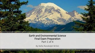
- 1. Earth and Environmental Science Final Exam Preparation Part 1 of 4 By Kella Randolph M.Ed. https://farm5.staticflickr.com/4098/4945037013_ded0a89f76.jpg
- 2. Some constellations are more prominent in the night sky of North Carolina in winter, while other constellations are more prominent in the night sky in summer because of Earth revolving around the sun https://static.skepticalscience.com/pics/Orbit_130_125kya_lg.jpg https://upload.wikimedia.org/wikipedia/commons/thumb/7/7c/Precession_animation_small_new.gif/290px- Precession_animation_small_new.gif
- 3. What is most likely to occur when the sun, moon, and Earth are aligned in a relatively straight line? There will be a larger-than-normal height difference between low tide and high tide https://c1.staticflickr.com/9/8512/8377997283_849f45c546_b.jpgThis Photo by Unknown Author is licensed under CC BY-SA-NC https://www.e-education.psu.edu/earth107/sites/www.e- education.psu.edu.earth107/files/Unit1/Mod2/Earth107Mod2Fig14.png https://s3-us-west-2.amazonaws.com/candimgs/u9pJri/Tidal_Range.jpg
- 4. The energy produced by the sun travels to Earth by the radiation of electromagnetic waves through space. This Photo by http://cdn.antarcticglaciers.org/wp-content/uploads/2014/11/cosmic-rays-5.jpg This Photo by https://2012books.lardbucket.org/books/regional-geography- of-the-world-globalization-people-and- places/section_16/6f92edca7d9c02dea591ebec2c7a1d97.jpg
- 5. Energy radiated from the sun heats Earth’s atmosphere and surface, which helps stabilize temperatures on Earth and creates environments more favorable for life to exist. https://c2.staticflickr.com/8/7073/13580531193_9f1608a552_b.jpg This Photo by Unknown Author is licensed under CC BY
- 6. Earth is not a perfect sphere. Because of its rotation about its axis, Earth has a greater circumference around the equator than around the Prime Meridian. http://www.sextant.org/en_wiki/images/3/37/Long%26LatPOI.jpg https://i.stack.imgur.com/MqICG.jpg https://en.wikipedia.org/wiki/Prime_meridian A prime meridian is a meridian (a line of longitude) in a geographic coordinate system at which longitude is defined to be 0°. Together, a prime meridian and its anti-meridian (the 180th meridian in a 360°-system) form a great circle. This great circle divides a spheroid, e.g., Earth, into two hemispheres.
- 7. Mountain ranges are geographic features that form as a result of continental-continental convergent plates. https://upload.wikimedia.org/wikipedia/commons/8/83/ Continental-continental_convergence_Fig21contcont.gif https://upload.wikimedia.org/wikipedia/commons/7/79/Himalayas.jpg
- 8. Most volcanoes are located at convergent boundaries,(plates push together), divergent boundaries (plates pull apart), and over hot spots (where magma pools form vents to the surface (such as the Hawaiian Island chain). https://upload.wikimedia.org/wikipedia/commons/thumb/b/b0/Map_plate_tectonics_world.gif/350px-Map_plate_tectonics_world.gif http://4.bp.blogspot.com/-vVv- YLtKzy8/Uk1zflCGdFI/AAAAAAAACsc/QtZ9CSceDNI/s1600/05+Mauna -Loa_listdose.com.jpg
- 9. Use a soil chart to determine the type of soil. • Loam contains • 40% sand, • 40% silt, • and 20% clay. • Soil texture diagram right: https://www.qld.gov.au/__data/assets/image/0031/65758/soil-texture- large.jpg https://www.ag.ndsu.edu/horticulture/images/soil2.jpg/@@images/f0a39764-0d2a-46df-95c1-caaf76ec5fae.
- 10. Minimize earthquake damage • Building structures that withstand ground vibrations would be most effective in minimizing the potential damage caused by an earthquake. • The illustration to the right is actually a video. To see it, copy the url and paste it into a new search bar. https://upload.wikimedia.org/wikipedia/commons/6/67/Bas e-isolation.gif
- 11. Newer bedrock is found at ocean ridges as lava wells up through deep cracks and trenches on the ocean floor. • Bedrock that is closer to oceanic ridges is younger in age than bedrock that is farther away. From that, we can conclude that the shape of Earth’s lithosphere is continually changing. https://opentextbc.ca/geology/wp-content/uploads/sites/110/2015/07/image023_2.pngThis Photo by Unknown Author is licensed under CC BY
- 12. Too much fertilizer = water pollution • Poor use of fertilizers in agriculture can affect the environment can cause pollution of water in lakes and rivers. http://www.mrgscience.com/uploads/2/0/7/9/20796234/525536_orig.png