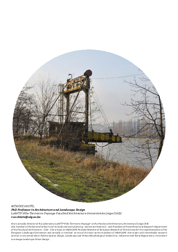
RITA OCCHIUTO,
PhD Professor in Architecture and Landscape Design
LabVTP Ville-Territoire-Paysage Faculté d’Architecture Université de Liège (ULG)
r.occhiuto@ulg.ac.be
She is actually Director of the Laboratory LabVTP“Ville-Territoire-Paysage”-at the Faculty of Architecture, University of Liège ( BE)
also member of the Doctoral School in Art to build and town planning - Section Architecture - and President of the Architectural Research Department
of the Faculty of Architecture – ULG - She is been an UNISCAPE Founder Member of European Network of Universities for the implementation of the
European Landscape Convention and actually is involved as one of the most active members of UNISCAPE. Her major and remarkable research
activity is concerned about Publica Spaces Design, Landscape and Urban Morphological Dialectiicts, Industrial and Rural Regneration, Innovation
to ménage Landscape Urban Design.
�INJURED LANDSCAPES:
REUSE & RECYCLE
di Rita Occhiuto
PAESAGGI INCISI:
RIUSO & RICICLO
di Rita Occhiuto
�22
The commitment requires that the
landscape and the complexity of the
issues that it brings up the body of the
European Convention: a text whose
thickness holds a multitude of possible readings that are too often simplified, deliberately circumvented or
ignored. This commitment implies an
involvement, which requires knowledge of places and conditions of the existing equilibrium, such as those of the
Dweller attentive to the evolution of
their environment. The same commitment is required at the designer who,
according Corajoud, must remain the
“guardian of the project,” to explicate
the contents, making them understandable and appropriated, accompanying
the process of transformation of space
over time. This position differs profoundly from the practice of project
that acts on points or areas, processing
refunds of initial reduced to a unique
representation for pictures at different
scales and dissected, that little dialo-
gue. It inserts derived from the context of uneven development, unable to
maintain or to weave new relationships
between spaces and meanings.
The implementation of the European
Landscape Convention requires more
interactive approaches that involve the
knowledge factory, bring into play the
University. The network UNISCAPEEUROPEAN NETWORK FOR THE IMPLEMENTATION OF THE EUROPEAN
LANDSCAPE fully welcomes the call to
action and aims to affirm the centrality of the landscape, to be treated as a
critical issue for knowledge and development. This involves the translation
from the classical notion of landscape
as a result of additional components to
the more contemporary, the landscape
as a subject of continuous interactions,
of which factors are inseparable and interdependent over time.
The seminars are transformed into
�Altoforno di Seraing sur Meuse, Belgio)
L’impegno che il Paesaggio richiede
e la complessità degli aspetti che esso
riunisce costituiscono il corpo della
Convenzione Europea: un testo il cui
spessore racchiude una molteplicità
di letture possibili che troppo spesso
vengono semplificate, eluse o volutamente ignorate. Tale impegno implica
un coinvolgimento, che richiede conoscenza di luoghi e condizioni d’equilibrio dell’esistente, come quelle
dell’abitante attento all’evolvere del
proprio ambiente. Lo stesso impegno
è richiesto al progettista che, secondo
Corajoud, deve restare il “custode del
progetto”, per esplicitarne i contenuti,
renderli comprensibili ed appropriabili, accompagnando il processo di trasformazione dello spazio nel tempo.
Questa postura differisce profondamente dalla pratica del progetto che
agisce per punti o per zone, elaborando
restituzioni di un unicum iniziale ridotto a una rappresentazione per quadri a
scale diverse e dissecate, che poco dia-
logano tra loro. Ne derivano inserti di
costruzioni sconnesse dal contesto, incapaci di mantenere o d’intessere nuove relazioni tra spazi e significati.
L’attuazione della Convenzione Europea del Paesaggio richiede approcci più
interattivi che, coinvolgendo le fabbriche del sapere, mettono in gioco le Università. La rete UNISCAPE-EUROPEAN
NETWORK FOR THE IMPLEMENTATION OF THE EUROPEAN LANDSCAPE
accoglie pienamente l’invito all’azione
e ambisce ad affermare la centralità
del paesaggio, da trattare come tema
critico di conoscenza e di sviluppo. Ciò
comporta la traslazione dalla nozione
classica del paesaggio come risultante
di componenti addizionali a quella, più
contemporanea, del paesaggio come
soggetto d’interazioni continue, i cui
fattori sono inscindibili ed interdipendenti nel tempo.
I seminari si trasformano così in meeting paesaggistici, volti ad articolare
questioni locali, corrispondenti alle
23
�Altoforno di Seraing sur Meuse, Belgio
meetings landscaped aimed at articulating local issues, corresponding to the
conditions of real landscapes in which
different universities of the network
are to act on a daily basis, with global
issues, corresponding to the generality
of problems instead of mutation, imbalance, degradation, isolation, fragmentation, and more.
“UNISCAPE En-Route”, because of its
itinerant character, will experience
from time to time a local landscape, to
perceive and understand in situ, from
which the emergence of more general topics and shared. From this time
travel and landscape could derive the
structure of a first overview composed from the set of snippets of territoriality particular - those in places of
belonging to the university network space-time assembly that precisely the
unfolding of the cycle seminars, could
lead to the definition of type-profiles of
the European landscape. And although
24
divided, disjointed and dismembered
in a variety of particles, will emerge
stories, origins and symptoms useful to
the identification of lines and methods
of intervention worthy of the thickness
of the Convention. In this way the differences and similarities could be considered as factors of new complementarity and cohesion to be placed in front
instead of what today is gradually making research of European competitiveness a process of self-destruction.
The fragmented landscape that sets us
apart is the mirror of the existing tensions and dialectics to be considered at
the same time as a poison antidote and
processes in place, a poison produced
by the forces opposed to the bitter end
between natural and man-made, but
at the same time an antidote, derived
from the study depth of the degenerative process in progress.
�condizioni di paesaggi reali nei quali le
diverse università della rete si trovano
ad agire quotidianamente, con questioni globali, corrispondenti invece alla
genericità di problematiche di mutazione, squilibrio, degrado, isolamento,
frammentazione ed altro.
“UNISCAPE En-Route”, proprio per il
suo carattere itinerante, intende sperimentare di volta in volta un paesaggio
locale, da percepire e comprendere in
situ, dal quale far emergere tematiche
più generali e condivisibili. Da questo
viaggio temporale e paesistico potrebbe derivare la struttura di un primo quadro sinottico composto dall’insieme di
frammenti di territorialità particolari –
quelle dei luoghi d’appartenenza delle
università della rete -, che nell’assemblaggio spazio-temporale proprio allo
svolgersi del ciclo di seminari, potrebbe condurre alla definizione di profilitipo del paesaggio europeo. E seppure
divisi, sconnessi e smembrati in molteplici particelle, ne emergeranno storie,
origini e sintomi utili all’individuazione di linee e metodi d’intervento degni
dello spessore della Convenzione. In
tal modo differenze e similitudini potrebbero essere assunte come fattori
di nuova complementarietà e coesione
da porre a fronte di quanto invece oggi
sta progressivamente facendo della ricerca di competitività europea un processo di auto-distruzione.
Il paesaggio frammentario che ci contraddistingue è lo specchio di tensioni
e dialettiche esistenti da considerare al
tempo stesso come veleno ed antidoto
dei processi in atto: un veleno prodotto dalla contrapposizione ad oltranza
tra forze naturali ed antropiche, ma nel
contempo un antidoto, derivante dallo
studio approfondito del processo degenerativo in corso. In effetti, è in esso
stesso che si trovano fasi ed elementi
significativi da riutilizzare per ristabilire equilibrio e co-azione per influenzare, accompagnare e persino invertire le
logiche di sviluppo.
25
�In fact, it is in the same phases and elements that are significant for reuse in
order to restore balance and co-action
to influence, accompany and even reverse the logic of development.
“In October, the Faculté d’Architecture
de l’Université de Liège (Ulg - Belgium)
organizes a seminar cycle UNISCAPE
En-Route to give voice and visibility to
the new landscape on which the University interacts on a daily basis through research, training and continuous
monitoring of the phenomena of transformation that inhabit and characterize it. The interest brought to the places dell’interagire daily, allows you to
answer one of the more complex missions established by the European Landscape Convention: engage and take
responsibility for the processes of learning, study, and dissemination project
that technical, scientific experimentation and thought socio-cultural expert,
produced by universities should be
able to support in order to fuel comparisons with the knowledge and management of a local nature. Starting from
26
the implicit knowledge (G. De Matteis)
contexts that still hold signs and narratives that have been dormant lost
readability, the seminar is offered as a
“laboratory” in which the local and the
global interact, the material and the
‘immaterial, formal and informal, as
well as anything factor that allows to
make visible and perceivable what’ is
no longer.
Topic CON-TEXT
“Engraved Landscapes: Reuse and
Recycling” - “Injured Landscapes: Reuse and Recycle”
Through a dialogue open system, the
theme invites us to rediscover the landscape text and / or context already
written, to know how to read and rewrite again, cyclically, continuously and
even almost involuntarily. The urge to
go back to reading the scriptures places refers to the request for design of
equal thickness and complexity of the
existing.
Writing leaving traces, leads us to re-
�In ottobre, la Faculté d’Architecture
de l’Université de Liège (Ulg - Belgio),
organizza un seminario del ciclo UNISCAPE En-Route per dar voce e nuova
visibilità al paesaggio con il quale l’università interagisce quotidianamente
attraverso ricerca,formazione ed osservazione continua dei fenomeni di trasformazione che lo abitano e lo caratterizzano. L’interesse portato ai luoghi
dell’interagire quotidiano, permette di
rispondere ad una delle missioni più
complesse stabilite dalla Convenzione
Europea del Paesaggio: impegnarsi e
farsi carico dei processi di conoscenza,
studio, progetto e diffusione che tecnicità, sperimentazione scientifica e pensiero socio-culturale esperto, prodotti
dalle università, devono riuscire a supportare allo scopo di alimentare confronti con saperi e gestione a carattere
locale. Partendo dal sapere implicito
(G. De Matteis) di contesti che detengono ancora segni e narrazioni sopite
di cui si è persa la leggibilità, il seminario si offre come un “laboratorio” al cui
interno interagiscono il locale ed il glo-
bale, il materiale e l’immateriale, il formale e l’informale, così come tutt’altro
fattore che permetta di rendere visibile
e percepibile ciò che non lo è più.
TEMA CON-TESTO
Paesaggi Incisi: Riuso e Riciclaggio
Injured Landscapes: Reuse and
Recycle
Attraverso un dialogo a sistema aperto,
il tema invita a riscoprire nel paesaggio un testo e/o un contesto già scritto,
da saper leggere e riscrivere di nuovo,
ciclicamente, ininterrottamente e persino quasi involontariamente. L’urgenza di tornare a leggere i luoghi rinvia
alla richiesta di scritture progettuali di
eguale spessore e complessità dell’esistente.
La scrittura lasciando traccia, porta a
riflettere sul senso dell’incisione, che
come nella metafora del palinsesto
(A. Corboz) - un supporto inciso a più
riprese, in cui il susseguirsi di scritture e cancellazioni non riesce mai ad
eliminare completamente i segni pre-
27
�Segni ValleMeuse
Univeristà di Liegi
R. Occhiuto
Planimetria generale dell’area degli altiforni a Seraing, Belgio.
HF6_ElisaBaldin_ClaudiaPorzionato_
IUAV&Fac. Architettura ULG Relatori R. Bocchi, R. Occhiuto
28
�Carta Van der MALEN 1850
Chaudfontaine
29
�flect on the meaning of the incision,
which, as in the metaphor of the palimpsest (A. Corboz) - support engraved on
several occasions, in which the succession of writings and cancellations can
never completely eliminate the signs of
pre-existing - pushes you to reconsider
the continuing actions that affect and
modify the materials of the landscape.
J. Derrida, referring to the writing evokes the responsibility inherent in deciding to support a plow, cutting it. A
groove is the result of decision and desire to write and modify the surface of
the soil, leaving the track. So if you write
it means changing the state of the soil,
even engrave projects, build and divert
existing lines already drawn by the interactions of natural and artificial phenomena, corresponds to permanently transform the existing one. These
scriptures or construction of natural /
artificial correspond to alterations, as
bearers of intentions that are followed
over time and often overlap in the show
familiar forms of reuse of previous signs and materials, thus giving rise to
30
the writings of recovery and prolongation existing in time.
The incision is an action that changes
in depth, but it is also a concept that
refers to the thickness of the material
“shake”. If build is meant to go beyond
the simple to organize, distribute, link,
or shape, for the purpose of integrating the consciousness to alter, affect
and reconfigure layers and balances
between the materials of the landscape,
every human action can acquire meanings deep that refer to the willingness
and ability to decide and act. The actions and the planning that goes with
it, depending on the attitude to make
choices based on systems capable of
adapting to the changing nature of the
interrelations that govern the balance
between natural and human forces.
Based on these theoretical assumptions, the theme of the seminar
- declined along the axes of the “memory”, “layering and schedule”, “interaction between man and nature” and
“design attitude or prospecting”- inspired by the observation of the succes-
�esistenti – spinge a riconsiderare il
persistere di azioni che toccano e modificano i materiali del paesaggio.
J. Derrida, facendo riferimento alla
scrittura, evoca la responsabilità insita
nel decidere di solcare un supporto, incidendolo. Un solco è frutto di decisione e volontà di scrivere e modificare la
superficie del suolo, lasciandovi la traccia. Quindi, se scrivere significa modificare lo stato del suolo, anche incidervi
progetti, costruirvi e deviare le linee
preesistenti, già tracciate dalle interazioni di fenomeni naturali e artificiali, corrisponde a trasformare in modo
permanente l’esistente. Tali scritture
o costruzioni con materiali naturali/artificiali, corrispondono ad alterazioni,
portatrici di intenzioni che si susseguono nel tempo e spesso nel sovrapporsi,
mostrano forme esperte di riuso di segni e materiali precedenti, dando luogo
così a scritture di recupero e di prolungamento dell’esistente nel tempo.
L’incisione è un’azione che modifica
in profondità, ma è anche un concetto
che rinvia alla densità del composto
di materiali. Se per costruire s’inten-
de andare oltre il semplice organizzare, distribuire, collegare o dare forma,
allo scopo d’integrare la coscienza di
alterare, incidere e riconfigurare strati
ed equilibri esistenti tra i materiali del
paesaggio, ogni azione antropica può
acquisire significati più profondi che
fanno riferimento alla volontà e alla capacità di decidere e di operare. Le azioni e la progettualità che ne consegue,
dipendono dall’attitudine ad operare
delle scelte fondate su sistemi capaci
di adattarsi alla mutevolezza delle interrelazioni che regolano gli equilibri
tra forze naturali ed umane.
Partendo da questi presupposti teorici, il tema del seminario - declinato secondo gli assi della “memoria”,
“stratificazione e palinsesto”, “interazione tra uomo e natura” e “attitudine
progettuale o di prospezione” – prende spunto dall’osservazione del succedersi delle azioni che hanno lasciato e
lasciano ancora segni nel paesaggio di
ancoraggio dell’università di Liegi: la
valle della Mosa, un insieme composito di artefatti naturali e umani, assunto
31
�Schemi delle linee delle “Iles Vallée”,
R. Occhiuto, Università di Liegi
sion of actions that have left and still
leave signs in the landscape anchor of
the University of Liege the Meuse valley with a combination of natural and
human artifacts, taken as a basic text
for studies, reflections, projects, actions and dynamic times to the future.
Entertained by close dialogue between
the city and the river, closely linked to
the concepts of fluctuation, instability
and cyclical shows the centrality of a
complex geomorphology of the island,
which became the subject site and the
alternation of phases with a strong
natural stages overthrow of the total
number of states of equilibrium achieved, due to the increasing dominance
of man on the environment.
32
From a landscape of island origin, consisting of a network of lands and waters
oblong unstable vagrant (ground zero),
precisely where most tumultuous rivers reached the Meuse, a space is
progressively fortified citadel which
looked like a Venetian lady belt from
the river. The expansion gives way to a
double movement of change. The existing rural landscape is attached on the
surface, the sprawling property of roadways, railways and waterways increasingly cutters and is in the basement,
crawl from the depths of industrial
workings from the bowels of the earth,
moves like a rhizome and creates corresponding resurgence in new industrial centers. The bucolic character of
a rural life more and more vanishing,
gradually gives way to a polycentric agglomeration that, relentlessly, day and
night, digging, burning, builds up and
sheds, gradually covering the old layer
of new signs of rural society emerging
industry.
Fields and villages suffer the interconnection of artefacts such as machines
and chimneys, with the mountains of
slag calls terril, transform the bucolic
landscape in an accumulation of mate-
�come testo di base per studi, riflessioni,
progetti, azioni e dinamiche volte verso
il futuro. Dal dialogo serrato intrattenuto tra città e fiume, intimamente legato
ai concetti di fluttuazione, instabilità e
ciclicità si evince la centralità di una
geomorfologia insulare complessa, divenuta luogo e materia dell’alternarsi
di fasi a forte valenza naturale a fasi di
sovvertimento totale degli stati d’equilibrio raggiunti, dovute al crescente dominio dell’uomo sull’ambiente.
Da un paesaggio d’origine insulare, costituito da un intreccio di terre
oblunghe instabili ed acque vagabonde
(ground zero), proprio là dove più corsi
d’acqua raggiungevano tumultuosamente la Mosa, trova progressivamente spazio una cittadella fortificata dalle
sembianze di una dama veneziana cinta dal fiume. L’espansione dà il via ad
un duplice movimento di mutamento.
Il paesaggio rurale esistente è attaccato sia in superficie, dalla struttura tentacolare di infrastrutture viarie, ferro-
viarie e fluviali sempre più trancianti e
sia nel sottosuolo, dallo strisciare profondo del lavorio industriale che dalle
viscere della terra, avanza come un rizoma e crea risorgenze corrispondenti
a nuovi nuclei industriali. Il carattere
bucolico di una ruralità sempre più
evanescente, cede progressivamente
il passo ad un’agglomerazione policentrica che, senza tregua, di giorno come
di notte, scava, brucia, accumula e getta,
ricoprendo gradualmente l’antico strato rurale di nuovi segni della società industriale emergente.
Campi e villaggi subiscono l’interconnessione di artefatti come macchine
e ciminiere che, con le montagne di
scorie chiamate terril, trasformano il
paesaggio bucolico in un accumulo di
materiali che sputano fumo, fuoco e
fiamme. Questo processo precoce di
sovrapposizione di un sistema sull’altro è l’inizio di uno sviluppo della città
e del suo intorno che procede voracemente ed ininterrottamente fino alla
33
�Canal Albert, Chertal, Belgio
rials that spew smoke, fire and flames.
This early process of superimposition
of a system on the other is the beginning of a development of the city and
its surroundings and voraciously that
proceeds without interruption until
the mid-twentieth century, passing
through a glorious phase in the nineteenth century in which man and nature,
collaborating, reconfigure the layout
river Meuse, reclaimed the unhealthy
districts of the old city center, creating
new functional areas in which new
types of buildings flanked boulevards,
gardens, squares, tree-lined walks and
riverside, enhancing the scenic quality
of the balance between river site and
architecture.
THE RIVER MOSA, INFRASTRUCTURE AS A LANDSCAPE
At this stage of reconciliation between
human actions and natural, it replaces
another that pushes the most of man’s
dominion over nature: the Meuse becomes an infrastructure of inland wa34
terways, serves industries, losing all
previous interactions urban and landscape. The end of the twentieth century marks the end of that domain and
energy crises and industrial stop gradually, until finally put to rest, the restlessness of an era that had no awareness of the limits of those same natural
systems with which it had previously
had the opportunity to collaborate.
Today the text of the Meuse valley
shows signs of deconstruction. The
profound change in the course touches
the structures of a syntax that ruled a
landscape and communities whose
cultures were closely linked to the nature of the substrate mining. When the
balance of the underground system
fails, the surface landscape takes the
form of abandonment.
The resurgent industrial, shutting
down, they release large portions of the
territory, creating a number of “enclaves” that alter the continuity of the landscape.
While the territory apparently shuts
�metà del XX secolo, passando attraverso una fase gloriosa nel XIX secolo
in cui uomo e natura, collaborando, riconfigurano il tracciato fluviale, della
Mosa, bonificano i quartieri insalubri
del vecchio centro, creano nuovi quartieri funzionali in cui nuove tipologie
edilizie affiancano boulevard, giardini,
piazze, passeggiate alberate e lungofiume, esaltando le qualità scenografiche
del rapporto equilibrato tra fiume, sito
ed architettura.
IL FIUME MOSA, COME INFRASTRUTTURA PAESAGGISTICA
A questa fase di conciliazione tra azioni
umane e naturali, ne subentra un’altra che spinge al massimo il dominio
dell’uomo sulla natura: la Mosa diviene una infrastruttura di trasporto fluviale, serve le industrie, perdendo tutte
le interazioni urbane e paesistiche precedenti. La fine del XX secolo segna la
fine di tale dominio e le crisi energetiche ed industriali arrestano progressivamente, fino a mettere a tacere definitivamente, la febbrilità di un’epoca che
non aveva coscienza dei limiti di quegli
stessi sistemi naturali con i quali precedentemente aveva avuto l’opportunità di collaborare.
Oggi il testo della valle della Mosa mostra i segni della decostruzione. Il cambiamento profondo in corso tocca le
strutture di una sintassi che ha governato un paesaggio e delle comunità le
cui culture erano strettamente legate dalla natura del sostrato minerario.
Quando l’equilibrio del sistema sotterraneo viene a mancare, in superficie il
paesaggio prende le sembianze dell’abbandono.
Le risorgenze industriali, in fase di spegnimento, liberano grandi porzioni di
territorio, creando numerose “enclaves” che alterano la continuità del paesaggio.
Mentre il territorio apparentemente
si spegne e perde le attività, sostituite
dall’oblio e dalla sospensione del tempo, altri fattori, meno visibili iniziano
ad agire: il sistema dei vuoti e le dinamiche vegetali. Infatti, il moltiplicarsi
dei tipi di luoghi già usati, alterati, deformati, incisi e persino feriti, conduce
alla paradossale visibilità dell’assenza,
provocata dal riassorbimento e sparizione delle precedenti emergenze.
I luoghi s’offrono allora alla ricolonizzazione vegetale, trasformandosi in
“friches”: luoghi di rinnovata dialettica naturale dal potenziale progettuale
poco o per nulla relazionato ai proget-
35
�down and loses its activity, oblivion and
replaced by the suspension of the time,
other factors begin to act less visible:
the system of voids and plant dynamics.
In fact, the proliferation of types of places have already been used, altered, distorted, and even engraved wounded,
leads to the paradoxical absence visibility, caused by the absorption and disappearance of previous emergencies.
Points then offer themselves to the
plant recolonization, becoming “waste
lands” means places of renewed natural dialectic of the potential design for
little or nothing related to the projects
reuse. The spread in large-scale returns of the absence of visibility in places such as the potential new resource
of sustainable development is still difficult to popular perception and adoption policy.
These engraved landscapes, are the
subject of dis-location, dis-junction and
dissociation (B. Goetz). Suffer, in general, the loss of each type of relationship
that allows the re-insertion into a system of elements perceptible. If you
look at most, a new feature that allows
the reuse of large areas and buildings
decayed and considered mere surfaces
and empty shells. But if it were possible to observe more closely the conditions and the characters, with their
potential to reunite the context, new
elements emerge, through the logic
design, hypothesis may give rise to new
urban landscapes and landscape structure. Reinserted into the structures
of territorial systems still active they
may embody “new chains of signifiers”
(Umberto Eco).
From the study of landscape of river
Mosa, emerge considerations that will
recognize other types of factors that
generate projects to structure flexible,
because designed to rebuild, revive
and promote new systems of interrelationships. These factors are:
- The dynamics in action, recorded in
36
situ (past, present, future)
- History, to be taken as an agent, which
is useful to the understanding and exploration
- Cyclicality and iterativity time, to be
adopted as a means of reflection design
- The recognition and use of systems
such as design instruments
- As long as the adjustment factor and
the accompanying design.
The valley of the Meuse as it still offers
an ideal test ground for understanding
how the phenomena of employment
and resorption are imbued from early
signs of industrialization. Today, in its
further change the landscape finds the
writings of the rural fabric, to be reinterpreted and re-enter in the event of
becoming more complex. The reappearance of the plot agrarian, must be
able to interact with other elements of
hybridization of the landscape, in order to overcome the state “dell’anthroposage”. This term designates Corboz
man’s action on the ground, reduced
to a single project or accumulation of
overlapping sites of various materials
intended only as storage media. Although today there is always more to
these lands as places to recover, clean
up and reclaim, the land resources are
not released yet reinserted into the
cycle of reconstruction of the new logic
of land use, as if they were actually new
resources for development. The “gap”
or “difference” that separates us from
that goal is not of a technical nature,
but on the conceptual order. Missing
In fact, the thought of “how to conceive
and transform” the space used in the
resource.
EUROPEAN CONVENTION
LANDSCAPE DESIGN
The readings, repeated over time, not
only reveal the descriptive character
�ti di riuso. Il diffondersi a larga scala
dell’assenza restituisce visibilità a dei
luoghi dei quali il potenziale di nuova
risorsa di sviluppo sostenibile è ancora
di difficile percezione popolare e adozione politica.
Tali paesaggi incisi, sono oggetto di
dis-locazione, dis-giunzione e dissociazione (B. Goetz). Soffrono, in generale,
della perdita di ogni tipo di relazione
che ne permetta il reinserimento in
un sistema di elementi percepibili. Se
ne cerca perlopiù, una nuova funzione
che permetta il riutilizzo di aree vaste
ed edifici decaduti e considerati mere
superfici ed involucri vuoti. Ma se si
riuscisse ad osservarne più attentamente le condizioni ed i caratteri, con
i loro potenziale di ricucitura del contesto, emergerebbero nuovi elementi
che, attraverso le logiche progettuali,
potrebbero dare origine ad ipotesi per
strutturare nuovi scenari urbani e paesistici. Reinseriti nelle strutture dei sistemi territoriali ancora attivi essi potrebbero dar corpo a “nuove catene di
significanti” (U. Eco).
Dallo studio del paesaggio Mosano
emergono considerazioni che permettono di riconoscere altre tipologie di
fattori che generano progetti a struttura flessibile, perchè concepiti per ricostruire, promuovere e rilanciare nuovi sistemi d’interrelazioni. Tali fattori
sono:
- le dinamiche in azione, rilevate in situ
(passate, presenti, future)
- la storia, da adottare come un agente,
utile alla comprensione e alla prospezione
- la ciclicità e l’iteratività temporale, da
adottare come strumenti di riflessione
progettuale
- il riconoscimento e l’uso di sistemi
come strumenti progettuali
- il tempo come fattore di regolazione e
di accompagnamento progettuale.
La valle della Mosa si offre tuttora
come un terreno sperimentale ideale
per comprendere quanto i fenomeni
d’occupazione e di riassorbimento si
siano compenetrati già dai primi segni
dell’industrializzazione. Oggi, nel suo
ulteriore mutare, il paesaggio ritrova le
scritture dei tessuti rurali, da reinterpretare e reinserire in ipotesi di divenire più complesse. Il riaffiorare della
trama agraria, deve poter interagire
con altri elementi di ibridazione del paesaggio, allo scopo di superare lo stato
“dell’anthro-posage”. Con questo termine Corboz designa l’azione dell’uomo sul territorio, ridotta ad un progetto
di solo accumulo o di sovrapposizione
di materiali vari su luoghi intesi come
soli supporti di stoccaggio. Anche se
oggi si guarda sempre più a queste
terre come a dei luoghi da recuperare, disinquinare e bonificare, le risorse
territoriali liberate non sono ancora
reinserite nel ciclo di ricostruzione di
nuove logiche di uso del suolo, come
se fossero realmente nuove risorse di
sviluppo. Il “gap” o lo “scarto” che ci
separa da tale obiettivo non è d’ordine
tecnico, ma d’ordine concettuale. Manca infatti il pensiero del “come concepire e trasformare” lo spazio usato in
risorsa.
PROGETTO: CONVENZIONE EUROPEA DEL PAESAGGIO
Le letture, reiterate nel tempo, non ci
rivelano solo i caratteri descrittivi di
un luogo. Consentendo di cogliere dei
fattori che influenzano i processi, esse
permettono di estrapolare le dinamiche e le ragioni che regolano le relazioni in corso. Anche se nella Convenzione non è fatta direttamente menzione
al metodo progettuale, in più punti si
sottolinea l’importanza dell’acquisizione di una percezione dinamica e di
proiezione in avanti. Il passaggio dalla
visione analitica alla processuale si riscontra “nell’aménagement”, caratterizzato da “azioni fortemente lungimiranti”, cioè “prospettive” o “volte
verso il futuro”. Se a questo si aggiun37
�Cambiamenti della
morfologia del paesaggio
nel tempo- Arie De Fijter,
dottorando per la "Guide
d'Architecture Moderne
Liège".
38
�39
�of a place. Allowing you to grasp the
factors that influence processes, they
allow to extrapolate the dynamics
and the reasons that govern the relationship going. Although the Convention does not directly mention is made
to the design method, in several places emphasizes the importance of the
acquisition of a dynamic perception
and projection forward. The transition
from the analytical view of the case is
found “nell’aménagement” characterized by “strong forward-looking action,” that is, “outlook” or “times into
the future.” If you add to this the objective of “enhancing, restoring and creating landscapes,” meaning to “create”
the ability to reconstitute or regenerate all places “whose character depends on the action of natural and human
factors in interrelation” you can not
ignore the intention of exploring the
text contains. Most of the European
territories of discontinued operations
require actions to the future, capable of
launching a new cycle of life. Knowing
how to detect existing forces in order to
rework the becoming in various forms,
corresponds to being able to make
choices in design intent. This requires
commitment and responsibility. The
commitment is also mentioned for the
training and awareness, to connect better to the practices of the project. The
active role is also required inhabitant,
through participation, not to make design choices, but to accompany him
and take care of him through the experience.
The Convention, as in the lyrics of “Engraved Landscapes”, terms and signs
still offer the potential to explore new
structures dependent on the logical
interpretation that is able to generate. Synthesis, structure, flexibility and
iteration give the project the role of a
cognitive process, as evidenced by the
practice landscape synthesized by A.
40
Foxley through the notions of “distance and engagement.” This double space-time dimension is invited to observe “inside” of the systems to be studied,
both the “distance” critical imperative
to seek new approaches for intervention. The project is understood as a
process of knowledge, adopting this approach landscaped, open paths perceptive and thoughtful research, adaptable
to each and every issue of intervention
that affect our landscapes.
The choice of types of marginal landscapes, recourse to the history of coactions between man and nature, together with the commitment to read the
ground, listening to stories and needs
of the inhabitants, while remaining
guardians of the project over time, are
the “income” that will be offered during the seminar for potential return
and confidence in the project.
This was adopted as a tool, and not as
an end, it may be declined by following
“mid-term perspectives of research,”
which reveal the potential and adaptability for concerted actions, advocacy and accompaniment. Moreover, in
the case of the urban landscape and he
rediscovered the size of “process and
approach.” Lending itself well to the
game of participation, accompanied by
the gradual refinement of ideas up to
accommodate new needs and temporality increasingly rapid mutation. The
result is a necessary paradigm shift
thinking about the project as a structure in progress. The practice of reusing and territories are still used today
among the most fertile interaction methodological issues.
The responsibility and commitment
in the exercise design are imposed to
make the project a flexible and adaptable in thickness, times and cultures,
which only in the diversity of dialectical built will find the energy, willpower
and confidence to return to write.
�ge l’obiettivo del “valorizzare, ricostituire e creare paesaggi”, intendendo
per “creare” la capacità di ricostituire
o di rigenerare tutti i luoghi “il cui carattere deriva dall’azione di fattori naturali e/o umani e dalle loro interrelazioni”, non si può ignorare l’intenzione
di prospezione che il testo contiene.
Gran parte dei territori europei in dismissione necessitano di azioni volte
al futuro, capaci di rilanciare un nuovo
ciclo di vita. Saper rilevare le forze esistenti allo scopo di rielaborarne il divenire sotto diverse forme, corrisponde
al saper operare delle scelte a finalità
progettuale. Ciò implica impegno e responsabilità. L’impegno è menzionato
anche per la formazione e la sensibilizzazione, da connettere meglio alle pratiche del progetto. Il ruolo attivo è richiesto anche all’abitante, attraverso la
partecipazione, non per operare scelte
di progetto, ma per accompagnarlo ed
accudirlo attraverso il vissuto.
Nella Convenzione, come nei testi dei
“Paesaggi Incisi”, termini e segni offrono ancora potenziali da esplorare,
dipendenti dalle nuove strutture logico-interpretative che si riuscirà a generare. Sintesi, struttura, flessibilità e
iterazione conferiscono al progetto il
ruolo di un percorso conoscitivo, come
testimoniato dalla pratica paesaggistica sintetizzata da A. Foxley attraverso le
nozioni di “distance and engagement”.
Questa doppia dimensione spaziotemporale invita sia all’osservazione
“dall’interno” dei sistemi da studiare,
sia alla “distanza” critica indispensabile per ricercare nuove ipotesi d’intervento. Il progetto inteso come processo di conoscenza, adottando questo
approccio paesaggistico, apre percorsi
percettivi e riflessivi di ricerca, adattabili a ciascuna delle problematiche
d’intervento che investono i nostri paesaggi.
La scelta di tipologie di paesaggi marginali, il ricorso alla storia delle co-azioni
tra uomo e natura, congiuntamente
all’impegno nel leggere il suolo, dando
ascolto a narrazioni e ai bisogni degli
abitanti, sempre restando custodi del
progetto nel tempo, sono le “entrate”
che saranno offerte durante il seminario per restituire potenziale e fiducia al
progetto.
Questo, adottato come uno strumento, e non più come un fine, può essere
declinato seguendo “prospettive intermedie di ricerca”, che ne rivelano
il potenziale e l’adattabilità anche per
azioni di concertazione, sensibilizzazione e accompagnamento. Inoltre, nel
caso del progetto urbano e di paesaggio
se ne riscoprono le dimensioni di “iter
e orientamento”. Prestandosi anche al
gioco della partecipazione, accompagna progressivamente l’affinarsi delle
idee fino ad accogliere nuovi bisogni e
temporalità sempre più rapide di mutazione. Ne deriva un necessario cambiamento di paradigma: pensare il progetto come una struttura in progress. Il
riuso e la pratica di territori usati sono
ancora oggi tra i temi più fertili d’interazione metodologica.
La responsabilità e l’impegno nell’esercizio progettuale s’impongono per
fare del progetto un sistema flessibile
ed adattabile a spessori, tempi e culture, che solo nella diversità delle dialettiche costruite saprà ritrovare l’energia, la volontà e la fiducia del tornare a
scrivere.
41
�
 Rita Occhiuto