Karen Pinto
University of Colorado, Boulder, Religious Studies, Department Member
- Islamic History, Islamic Studies, Medieval Islamic History, Middle East History, Middle East Studies, Early Islam, and 158 moreMiddle Eastern Studies, Turkish and Middle East Studies, Mapping Visual Histories, Mapping, Maps and Society, Medieval Cartography, Cultural Mappings, Historical maps, Mental Maps, Conflict Mapping, Critical Cartography, History of Cartography, Concept Mapping, Social cartography, Radical Cartography, Cartography, Islamic Cartography, Merleau-Ponty, Phenomenology of Space and Place, Space and Place, Collective Memory, History and Memory, Cultural Memory, Cultural Studies, Cultural Theory, Humanities, Digital Humanities, Visual Studies, Visual Culture, Visual propaganda, Art and cartography, Husserl, al-Istakhri Kitab al-Masalik wa-al-Mamalik, Ottoman History, History of the Islamic World, Islamic Philosophy, Arabic Manuscripts, Abbasid History, Ottoman Studies, Medieval Islam, Early Islamic History, Art and science of cartography, the human experience of space and place, environment and image, Nautical cartography and navigational science in the Mediterranean World from the Late Middle Ages to the 18th century, History, Philosophy of Mind, Martin Heidegger, Sense of Place, Cultural Geography, Material Culture Studies, Anthropology of space, Geography, Space Syntax, Landscape Archaeology, Mediterranean archaeology, Medieval Islamic, Turco-Iranian World, Mongol world empire Seljuk, Mongol, post-Mongol, Ottoman Anatolia (1200-1500) Comparative empire, Frontier, political culture Persian, Ottoman Turkish historical writing, Al-Andalus, Early and Medieval Islamic Art and Architecture, Early Islamic Archaeology, Islamic Archaeology, Mehmed II, Bookbinding, Codicology, Decorative Papers (Especially Marbled Papers), Islamic Manuscripts, Craft Guilds, Technical Poety, Islamic manuscript, Codicology of Qur'an, Civilisation and Culture, Cultural Landscape, Historical Landscape, Heritage, Knowledge, Information, Participation, Ethics, Discourses, Semantics, Web 2.0, Visualization, Critical Geography, Piri Reis, History of Melilla, Mediterranean Studies, Art History-Seljuk art, Religious History, Medieval Studies, Umayyads (Islamic History), Islamic History and Muslim Civilization, Medieval History, Medieval Iberian History, Manuscripts (Medieval Studies), Islamic Sciences, Science and Islam, Islamic Science, Comparative medieval history, Anatolian History, Medieval Asia Minor, Islamic Intellectual History, Safavids (Islamic History), Cartographic History, History of the Mediterranean, Arab-Byzantine relations in the Medieval Mediterranean, Arabo-Byzantine Studies, Islam and Christianity: relations and exchange of ideas, Medieval Sicily, Arab-Islamic History and Civilization and their relations with Byzantium, Thughur, Archaeology in Turkey, Lebanon, Syria, Israel and Palestine (History and Archaeology), Levantine Archaeology, Fatimids, Social Network Analysis (SNA), Late Antique and Byzantine History, Historical GIS, Historical Geography, Mediterranean, Trade Routes, Global History, Andalusia/Al-Andalus, Neoplatonism and late antique philosophy, Space And Place (Art), Language, Space and Place, Place Attachment, Memory Places, Jeff Malpas, Hermeneutics, Philosophical Topography, Hans-Georg Gadamer, Archaeology, Technology, Philosophy, Anthropology, Art History, E-learning, Philosophy of Science, Psychology, Artificial Intelligence, Human Rights, New Materialism, Materiality, Exception, Spatial Theory, Spatiality, Boundaries, Islamic Art, Islamic Calligraphy, Manuscript Studies, Codicology of Islamic Manuscripts, and History of librariesedit
- Growing up in Karachi, Pakistan, I somehow became map crazed. Was it the countless jigsaw puzzles, many with missing ... moreGrowing up in Karachi, Pakistan, I somehow became map crazed. Was it the countless jigsaw puzzles, many with missing pieces, that I broke and remade again and again during childhood, all too often holed up in a hospital bed? Or perhaps it was the wonderful family field trips into the heart of the Sindh desert?
During my Convent of Jesus and Mary (CJM) O’Level school days, I excelled in geography for which my own hand drawn maps were well known among my classmates. My teacher loved them and my friends liked to take a peek at them in order to improve their own. ;-)
American educational good fortune first smiled on me when Dartmouth decided to take in their first student from Pakistan :) At the Big D I got down to the ground and did some 'real' mapping and even fell into the Connecticut river while trying to map one of its banks! Off the Green, I merged the interests in geography and history that sustain me today.
From there I headed to Columbia ostensibly to study International affairs but I took an accidental elective detour into a spell-binding Bulliet class on medieval Islamic history and was hooked thereafter—like a number of other unsuspecting SIPA grads :) Through the accident of stumbling upon a crumbling copy of Konrad Miller's early 20th century Mappae Arabicae in Baker Library in Spring 1990, while hunting for my MA topic I began a medieval odyssey that made me an expert in the world of medieval Islamicate carto-geography. And so was kindled a quest to see as many medieval Islamicate maps in situ as possible. Now, having collected 3,000 plus images from manuscript libraries around the world, I am deeply immersed in the study of medieval Islamic maps. One book is out ("Medieval Islamic Maps"), three others are on the way ("The Mediterranean in the Medieval Islamicate Imagination" (based on my like-named MA essay of 1991), "What is Islamic about 'Islamicate' Maps," and "Islamo-Christian Cartographic Connections." Plus I am working on a digital site MIME (Medieval Islamicate Maps Encyclopedia) to preserve and make the maps available online. Many of the maps are from hard-to-access manuscript libraries in the Middle East and Europe. Starting in 1992 at Topkapi Saray and Sülemaniye libraries in Istanbul, I have devoted 3 decades to examining, dating/redating, and identifying the maps and the manuscripts that house them.
I love to travel and am especially fond of finding unknown and lost places and ofc I am always on the lookout for unknown maps—especially those that are not easily identifiable as maps. My special interest is seeing maps where no one saw a map before and explaining how and why that unknown image is a map ;-)
In Idaho my favorite “hard-to-figure-out-it’s-a-map” map is "Map Rock" outside Celebration Park :)
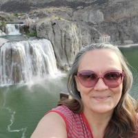
Profile Picture: Twin Falls, Idaho, Summer 2021.edit
https://press.uchicago.edu/ucp/books/book/chicago/M/bo17703325.html Hundreds of exceptional cartographic images are scattered throughout medieval and early modern Arabic, Persian, and Turkish manuscript collections. The plethora of... more
https://press.uchicago.edu/ucp/books/book/chicago/M/bo17703325.html
Hundreds of exceptional cartographic images are scattered throughout medieval and early modern Arabic, Persian, and Turkish manuscript collections. The plethora of copies created around the Islamic world over the course of eight centuries testifies to the enduring importance of these medieval visions for the Muslim cartographic imagination. With Medieval Islamic Maps, historian Karen C. Pinto brings us the first in-depth exploration of medieval Islamic cartography from the mid-tenth to the nineteenth century.
Pinto focuses on the distinct tradition of maps known collectively as the Book of Roads and Kingdoms (Kitab al-Masalik wa al-Mamalik, or KMMS), examining them from three distinct angles—iconography, context, and patronage. She untangles the history of the KMMS maps, traces their inception and evolution, and analyzes them to reveal the identities of their creators, painters, and patrons, as well as the vivid realities of the social and physical world they depicted. In doing so, Pinto develops innovative techniques for approaching the visual record of Islamic history, explores how medieval Muslims perceived themselves and their world, and brings Middle Eastern maps into the forefront of the study of the history of cartography.
Research Interests: Aesthetics, Architecture, Middle East Studies, Middle East History, Islamic Philosophy, and 30 moreHistory of Cartography, Middle Eastern History, Turkish and Middle East Studies, Islamic Art, Islamic Studies, Medieval Cartography, Middle Eastern Studies, Cartographic History, Islamic History, Early Islamic Art, Early and Medieval Islamic Art and Architecture, Critical Cartography, Historical Cartography, Indo-Islamic Art and Architecture, Byzantine Western Medieval Islamic Art & Architecture, Islamic Arts, Islamic art history, Arabic and Islamic Art History, Islamic art and architecture, Islamic art and archaeology, Islamic and Middle Eastern studies, Historical Geography, Historical Cartography, Environmental History, Painting, Orientalism, iconography, Middle East, Art History, Islamic civilization, iconology, near east, cultural criticism, oriental veil, veiling and unveiling, female portraiture, Turkish Islamic Arts, history of Islamic art in Timurid era, Islamic Art and History, Mamluk Sultanate, Turkish and Islamic Art and History, Near and Middle Eastern Studies, Islamic Book Arts, and Geometric Patterns In Islamic Art
Did medieval European maps influence the Islamicate ones or vice versa? Or, were they mutually exclusive? Scholars fall on both sides of the divide and the question of Islamo-Christian cartographic connections remains elusive due to the... more
Did medieval European maps influence the Islamicate ones or vice versa? Or, were they mutually exclusive? Scholars fall on both sides of the divide and the question of Islamo-Christian cartographic connections remains elusive due to the lack of extant examples. This article focuses on the author of the Arabic notations on a rare ninth-century copy of Isidore’s geographical treatise of Etymologiae, and, in particular, on its T-O map with the aim of revealing that the notations were made by a distinguished Arab geographer of princely stock from caliphal Andalus and not just an unknown anonymous Mozarab - Iberian Christians including Christianized Iberian Jews who lived under Muslim rule in the southern sections of the Iberian peninsula from the early eighth century until the mid-fifteenth century including those who escaped to the Christian kingdoms of Aragon, Asturias, and Castile. I aim to prove that the majority of the Arabic annotations on a late eighth/ early ninth-century Visigothic Latin Isidorean manuscript of Isidore’s Etymologiae, Ms. Vitr. 014/003, housed at Madrid’s Biblioteca Nacionale de Espana (BNE) were made by Abū ʿUbayd ʿAbdallāh al-Bakrī (d. 487/1094), an Andalusi geographer of princely background, whose mid-eleventh century Islamicate geography Kitāb al-masālik wa al-mamālik (Book of Routes and Realms) influenced many a later medieval Islamicate geographical scholars. The most famous was Yāqūt al-Ḥamawī (d. 626/1229), an inveterate medieval Islamicate-world traveling scholar of Byzantine stock who relied heavily on al-Bakrī’s geography for his seven volume magnum opus, a geographical dictionary on countries and places called Muʿjam al-Buldān (Dictionary/Collection of Countries, completed 1224-1228) that is considered one of the most comprehensive medieval Arabic geographical dictionaries ever written because it provides mini-encyclopedic entries on thousands of sites in the Islamicate realm of the Middle Ages. If al-Bakrī used Isidore’s Etymologiae for his conclusion, then it could be asserted that Yāqūt and other medieval Islamicate geographers who relied on al-Bakrī’s may have been influenced a little by Isidore. This article aims to provide proof of significant scholarly connections between medieval European and Islamicate carto-geographical traditions centuries earlier than previously presumed. In doing so it adds to the story of transcultural connectivity across the greater Mediterranean that can be examined under the central question informing this latest volume by Albrecht Classen as to whether globalism existed in the pre-modern world.
Research Interests: History of Cartography, Mozarabs, Islamic Studies, Medieval Cartography, Al-Andalus, and 15 moreHistory of the Islamic World, Islamic History, Medieval Islamic History, Al Andalus (Islamic History), History of Islamic Civilization, Arabic Manuscripts from Andalus, Andalusia/Al-Andalus, Early Islamic History, Islamic History and Muslim Civilization, Al-Andalus History, Islamic Spain, Islamic Cartography, Isidore of Seville, History of Maghrib and Andalus, and Intellectual History of Al andalus
This article explores the spiritual underpinnings of the forms used in Islamicate world maps. After a brief overview on the 'Kitāb al-masālik wa-al-mamālik' ('Book of routes and realms'-abbreviated to KMMS) Islamicate mapping tradition,... more
This article explores the spiritual underpinnings of the forms used in Islamicate world maps. After a brief overview on the 'Kitāb al-masālik wa-al-mamālik' ('Book of routes and realms'-abbreviated to KMMS) Islamicate mapping tradition, the author examines the meaning behind the form of a bird that constitutes the shape of the landmasses of the old world. In Islamic culture the bird is an oft-repeated motif with a multitude of meanings related to the bird's reflection of soul and its ability to be closer to the heavens and God. Through an examination of the bird in the world map this article points to the multitude of Islamic cultural, philosophical, and spiritual signs embedded in Islamicate cartography.
This article is extracted from Pinto’s in-process book on “What is Islamic about Islamicate Maps?”
This article is extracted from Pinto’s in-process book on “What is Islamic about Islamicate Maps?”
Research Interests: Cartography, Islamic Philosophy, History of Cartography, Islamic Art, Islamic Studies, and 15 moreSufism, Medieval Cartography, Neoplatonism, Medieval Islamic History, Islamic Thought & Philosophy, Philosophy and Thought in Islamic Science, Avicenna, Critical Cartography, Historical Cartography, Birds, Islamic art and architecture, History and Philosophy of Islamic education, philosophical Sufism (school of Ibn 'Arabi), Ancient Cartography, and Intellectual History of the Islamicate World
Tucked away in the sand and sun of the Syro-Arabian desert that separates Jordan from Syria and Iraq is a most unusual spherical image. Housed in Quṣayr ‘Amra, the bath house of an Umayyad prince, amidst images of famous kings and nude... more
Tucked away in the sand and sun of the Syro-Arabian desert that separates Jordan from Syria and Iraq is a most unusual spherical image. Housed in Quṣayr ‘Amra, the bath house of an Umayyad prince, amidst images of famous kings and nude women, is an enigmatic gift. In this paper, I discuss interpretations of this unusual image and argue that it should be considered the earliest extant Islamic map or—better still—the earliest extant mimetic painting of the moon! 🌝
For copy with all maps in color see: https://scholarworks.wmich.edu/tmg/vol4/iss2/3/
For copy with all maps in color see: https://scholarworks.wmich.edu/tmg/vol4/iss2/3/
Research Interests: Cartography, History of Science, History of Cartography, Islamic Art, Islamic Studies, and 15 moreMaps and Society, Mental Maps, Concept Mapping, Islamic History, Historical maps, Early and Medieval Islamic Art and Architecture, Jordan (History), Mapping, Digital mapping, Islamic art and architecture, Archaeology of Jordan, Moon, Selenography, History of Muslim Cartography, and Qusayr 'Amra
Translation is a two-way street. Or so the maps that I harness for the purposes of this chapter intimate: one a medieval European T-O map labeled in Arabic and the other a medieval Islamic geographical atlas made in Norman Sicily. One was... more
Translation is a two-way street. Or so the maps that I harness for the purposes of this chapter intimate: one a medieval European T-O map labeled in Arabic and the other a medieval Islamic geographical atlas made in Norman Sicily. One was interpreted by a famous eleventh-century Andalusi Muslim geographical scholar of Arab descent and the other illustrated by a Siculo-Arab cartographic artist may have had an influence on the childhood psyche of the emperor, Frederick II, who went on to be called Stupor Mundi (Wonder of the world). One ended up influencing the composition of an Arabic geographical text and the other had an impact on a segment of the Kitāb al-masālik wa-al-mamālik (Book of routes and realms) KMMS Islamic mapping tradition. Each speaks to crucial sides of translation: interpretation, intention, and impact. These are the sides that I focus on in this chapter.
This analysis provides us with an opportunity to explore the question of Islamo-Christian cartographic connections. Did medieval European maps influence the Islamic ones or vice versa? Or were they mutually exclusive? It is one of the major unresolved debates in the history of cartography. Scholars fall on both sides of the divide. A definitive answer to the question has been hampered by the lack of extant examples demonstrating Islamo-Christian cartographic connections. A decade ago a medieval European T-O map labeled in Arabic came back into the limelight after a forty-year hiatus and recently I identified a KMMS geographic atlas as having been produced in the late twelfth century Norman court of Sicily. Taken together these new identifications make it possible to update the discourse on the question of Islamo-Christian cartographic connections.
After years of noticing, collecting, and researching cartographic connections between the Muslim and Christian worlds, I am convinced that ideas of medieval map construction did indeed diffuse across the Mediterranean and that these cartographic ideas diffused multidirectionally in a series of back-and-forth iterations that ultimately informed and enriched the cartographic traditions of both cultures.
Research Interests: Cartography, Medieval History, Middle East Studies, History of Cartography, Medieval Cartography, and 15 moreCartographic History, History of the Islamic World, Islamic History, Medieval Islamic History, Al Andalus (Islamic History), Islamic Intellectual History, Islamic History and Muslim Civilization, Historical Cartography, Siculo Arabic, Cartografia Humanistica, Cartografia Cultural, Islamic Geography, Islamic Medieval Geography, History of Muslim Cartography, and Siculo-Norman Art
In keeping with the theme of Treasures of the Sea, this article focuses on the sacrality embedded in the depiction of the seas in the medieval Islamic KMMS mapping tradition. Teasing apart the depictions, this article analyses the sacred... more
In keeping with the theme of Treasures of the Sea, this article focuses on the sacrality embedded in the depiction of the seas in the medieval Islamic KMMS mapping tradition. Teasing apart the depictions, this article analyses the sacred dimensions of the five seas that make up the classical KMMS image of the world: Baḥr al-Muḥīṭ (the Encircling Ocean), the Baḥr Fāris (Persian Gulf-Indian Ocean-Red Sea), Baḥr al-Rūm (the Mediterranean), Baḥr al-Khazar (Caspian Sea),and Buḥayrat Khwārizm (Aral Sea).
Keywords Islamic cartography; History of Cartography; Illuminated manuscript; Encircling Ocean; Mediterranean; Indian Ocean; Persian Gulf; Sacred Relics of Prophet Muhammad.
https://tinyurl.com/Sacral-Seas
Keywords Islamic cartography; History of Cartography; Illuminated manuscript; Encircling Ocean; Mediterranean; Indian Ocean; Persian Gulf; Sacred Relics of Prophet Muhammad.
https://tinyurl.com/Sacral-Seas
Research Interests:
At first glance the typical medieval Islamic map of ‘the West’—Surat al-Maghrib— strikes us as nothing more than a quaint abstraction of circles, triangles, and oblong shapes ornately adorned with vivid pigments. Closer study presents a... more
At first glance the typical medieval Islamic map of ‘the West’—Surat al-Maghrib— strikes us as nothing more than a quaint abstraction of circles, triangles, and oblong shapes ornately adorned with vivid pigments. Closer study presents a more complex image, however, of passion and conflict; of attraction and revulsion; of love and hate. Indeed the Maghrib map is by far the most dissonant image in the extant collection of medieval Arabic and Persian maps and, as such, one of the most engaging. Whereas all the other images have a veneer of harmony and balance, this one is—by deliberate design—passionately conflicted. It is the discord of desire inlaid within the Muslim pictographs of the Maghrib that is the focus of this chapter, the over-arching question being how did medieval Islamic cartographers settle on such a strange looking image as a representation of the Western Mediterranean— in particular, North Africa, Islamic Spain, and Sicily? Answering this question requires immersing ourselves in the map-image itself, and takes us through a series of subliminal messages ranging from intra-Islamic imperial ambitions to erotic and nostalgic Andalusian poetry.
Research Interests: Cartography, Ethics, Communication, Web 2.0, Visualization, and 106 moreMiddle East & North Africa, North Africa Studies, Semantics, North Africa (Anthropology), History of Cartography, Literature and Politics, Participation, Sufism, Critical Geography, Egypt, Medieval Cartography, Al-Andalus, Morocco, Gregorian Chant, Al Andalus (Islamic History), Arabic Historiography (History), Emotional Cartography, Translation, Radical Cartography, Rumi, Trade, Arabic Manuscripts from Andalus, Mediterranean and North Africa, Andalusia/Al-Andalus, Medieval Spain, Spain, Heritage, Knowledge, Pottery, Italy, Al-Andalus archaeology, Al-Andalus History, Critical Cartography, Historical Cartography, Information, Raymond Martini, Juan Andrés, North African History, Medieval Spain and North Africa, Maghreb, Mapping, Medieval Iberia, Conversion, Algeria, Tunisia, Andalusia, Cultural Landscape, Islamic Medieval History, Gharb al-Andalus, North Africa, North African Archaeology, History of the Sahara, Sahel and North Africa, Andalusian Manuscripts, Islamic Cartography, History of al-Andalus, Metalwork, Garb al-Andalus, Abner of Burgos, Discourses, Historia medioevo hispánico (cristiano y andalusí), Historical Geography, Historical Cartography, Environmental History, Medieval archeology, landscape archeology, Al-Andalus, Middle East and North Africa, Andalusian Studies, Moors, Andalusi Arabic, Art History, Art and Architecture of Pre-Modern Islamic Cultures, Maghrib and the Mediterranean Basin, Cartography and Literature, History and archaeology of al-Andalus, Historical Landscape, Trans Sahara Trade North Africa, Trance, Art and cartography, Euro-Mediterranean Relations, Art and science of cartography, the human experience of space and place, environment and image, Andalusian Literature, Al-Andalus (8th-15th centuries), Al-Andalus. Iberian Peninsula. Classical Arabic geographical literature, History of Maghrib and Andalus, histoire sociale d'al-Andalus (VIIIe-Xe siècle), Umayyad dynasty al-Andalus, Al-Andalus Iconography, Berbers. Amazighs. History of Berbers. Cultural and Political Claims. Cultural and Berber Movement. North of Africa. Algeria. Morocco., Al-Andalus society, The Nasrid Kingdom of Granada, Al Andalus, medieval Maghrib, Anthropology of the Mediterraenan, Spanish Folkore, Local Traditions, Cult of Images, Holy Bodies, Hiberno Saxon Art, Maghribi Art, Pottery In Byzantium, Hispano medieval Studies, Hispano arabic Studies, Sephardic Literature and Culture, Polemics and Apologetics, Literatura Sefardí, Intellectual History of Al andalus, Morocco. Culture, Islamic Archaeology & Anthropology, Specialy of Al Andalus . Items: Functional Archaeology, Settlement Patterns and Systems, and Pilgrimages As Vehicles for Technical and Cultural Interchange
Searchin’ his eyes, lookin’ for traces: Piri Reis’ World Map of 1513 & its Islamic Iconographic Connections (A Reading through Baghdat 334 and Proust) Abstract ␣ The remnant of the 1513 world map of the Ottoman corsair (and later admiral)... more
Searchin’ his eyes, lookin’ for traces: Piri Reis’ World Map of 1513 & its Islamic Iconographic Connections (A Reading through Baghdat 334 and Proust) Abstract ␣ The remnant of the 1513 world map of the Ottoman corsair (and later admiral) Muhiddin Piri, a.k.a. Piri Reis, with its focus on the Atlantic and the New World can be ranked as one of the most famous and controversial maps in the annals of the history of cartography. Following its discovery at Topkapı Palace in 1929, this early modern Ottoman map has raised baffling questions regarding its fons et origo. Some scholars posited ancient sea kings or aliens from outer space as the original creators; while the influence of Columbus’ own map and early Renaissance cartographers tantalized others. One question that remains unanswered is how Islamic cartography influenced Piri Reis’ work. This paper presents hitherto unnoticed iconographical connections between the classical Islamic map- ping tradition and the Piri Reis map. Keywords: Piri Reis, World Map of 1513, Ottoman Cartography, Islamic Cartogra- phy, Islamic Wondrous Tradition, Islamic Manuscript Illumination.
Research Interests: History of Cartography, Maps and Society, Cultural Mappings, Islamic manuscripts illumination, Historical maps, and 9 moreMarcel Proust, Mapping, Islamic Cartography, Topkapi, al-Istakhri Kitab al-Masalik wa-al-Mamalik, Ottoman geography, travel literature and cartography, Thomas Goodrich, Piri Reis, and Islamic Wonder Tradition
Maps were the coincidental locus of the Ottoman Sultan Mehmet II's most passionate interests: war and art. So far, the focus has been upon the famed conqueror (Fâtih) of Constantinople's interest in, and demand for, European maps without... more
Maps were the coincidental locus of the Ottoman Sultan Mehmet II's most passionate interests: war and art. So far, the focus has been upon the famed conqueror (Fâtih) of Constantinople's interest in, and demand for, European maps without mention of his patronage of classical Islamic cartographic material. In this article, I expand the perspective on Mehmet's cartographical milieu by inserting into the historical picture consideration of a recension of cartographically illustrated manuscripts, those of al-Istakhri's Kitab al-Masalik wa-al-Mamalik [Book of Roads and Kingdoms], dating from 1474 onwards and made in post-conquest Ottoman Constantinople. I also set out the circumstances under which this ‘cluster’ of manuscripts may have been copied and, by focusing on the world maps in particular, suggest ways in which the maps can be interpreted as cultural artefacts. I conclude by indicating how this particular group of manuscripts provides insights into map audience, patronage and propaganda in fifteenth-century Anatolia.
Research Interests: Ottoman History, History of Cartography, Ottoman Studies, Turkish and Middle East Studies, Concept Map, and 23 moreOttoman Empire, Maps and Society, Mental Maps, Cultural Mappings, Early modern Ottoman History, Islamic manuscripts illumination, Historical maps, History of Ottoman Art and Architecture, Turco-Iranian World, Economic and Social History of the Ottoman Empire, Mapping, Mongol, Islamic Cartography, Frontier, Mehmet II, Ottoman Cartography, al-Istakhri Kitab al-Masalik wa-al-Mamalik, Medieval Islamic, post-Mongol, Mongol world empire Seljuk, Ottoman Turkish historical writing, Ottoman Anatolia (1200-1500) Comparative empire, and political culture Persian
Every medieval Islamic cartograph of the world contains a curious anomaly. Consistently located on the eastern flank of Africa is a double-territorial ethnonym for an obscure East African tribe: the Buja (marked on Figure 1 with a red... more
Every medieval Islamic cartograph of the world contains a curious anomaly. Consistently located on the eastern flank of Africa is a double-territorial ethnonym for an obscure East African tribe: the Buja (marked on Figure 1 with a red circle). Mention of them in medieval Middle Eastern historiography is rare and, at best, superficial, yet no Islamic mappamundi from the 11th to the 19th century leaves them out. Not only are the Buja privileged with a permanent berth on the Islamic world map, they are also the only place on the map signified with a double territorial marking. The question that I raise in this paper is, quite simply, who were the Buja? Why are they so absent in Islamic historiography, yet so present on the mappamundi? The answer emerges from a series of droll and puzzling references that hint at the oddest reasons for the emphasis; reasons which, in turn, cause us to question our notions of how and why places make it on to maps. The query reveals surprising answers that can be relegated to the Husserlian domain of "retentions," "reproductions," and "protentions."
Out of this questioning of medieval Islamic maps, it is the temporal imagination that emerges as the dominant architect of cartographic space. It presents itself as an imagination that is triggered as much by the extreme alterity of otherness as it is by the subtle reflection of self.
Out of this questioning of medieval Islamic maps, it is the temporal imagination that emerges as the dominant architect of cartographic space. It presents itself as an imagination that is triggered as much by the extreme alterity of otherness as it is by the subtle reflection of self.
Research Interests: Middle East Studies, Middle East & North Africa, History of Sub-Saharan East Africa, Islamic History, Medieval Islamic History, and 4 moreProjects: Espaços e Arquitecturas em Tell Beydar & Arqueologia das Cidades de Beja., Islamic Cartography, Islamic law in East Africa, Contemporary Muslim trends in East Africa and Muslim intellectual contributiions in East Africa, and Beja
In this paper, I examine and deconstruct the “classical” medieval Islamic conception of the Mediterranean as seen through colorful, miniature maps found in medieval Arabic and Persian geographical manuscripts from the 11th to 17th... more
In this paper, I examine and deconstruct the “classical”
medieval Islamic conception of the Mediterranean as seen through colorful, miniature maps found in medieval Arabic and Persian geographical manuscripts from the 11th to 17th centuries. In his classic book “Mohammad and Charlemagne” (1939), the Belgian scholar Henri Pirenne set forth what has since come to be known as the Pirenne thesis, expressing the dominant European view that the sudden advent of Islam
on the “other” side of the Mediterranean disrupted the unity of the “Roman Lake” forever. “With Islam a new world was established on those Mediterranean shores, which had formerly known the syncretism of the Roman civilization. A complete break was made, which was to continue even to our own day. Henceforth two different and hostile civilizations existed on the shores of Mare Nostrum. The sea, which had hitherto been
the center of Christianity became its frontier”. A similarly antagonistic picture is presented by some scholars of the medieval Islamic approach to the Mediterranean. (See, for instance, André Miquel’s discussion of the subject in “La géographie humaine du monde musulman”). Do the detailed
maps of the Mediterranean and its surrounding littorals prepared by medieval Muslim geographers reinforce this traditional, polarized, oppositional view? If not, what kind of a vision of the sea do the maps present? What can the pictorial depictions of the sea be taken to signify? Did they mutate over time? The surprising, counter-intuitive responses to some of these questions form the core of this paper.
Research Interests:
ABSTRACT Ways of Seeing.3: Scenarios of the World in the Medieval Islamic Cartographic Imagination Karen C. Pinto This dissertation concerns the stylized carto-ideographs—specifically representations of the world—that illustrate... more
ABSTRACT
Ways of Seeing.3: Scenarios of the World in the Medieval Islamic Cartographic Imagination
Karen C. Pinto
This dissertation concerns the stylized carto-ideographs—specifically representations of the world—that illustrate medieval Islamic geographical manuscripts. There are hundreds of cartographic images scattered throughout the medieval and early modern Arabic, Persian, and Turkish manuscript collections. Yet these maps have often been deliberately ignored on the grounds that they are not "mimetically" accurate representations of the world. What many failed to see is that these images are iconographic representations of the way in which the medieval Muslims perceived their world.
This dissertation explores the applicability of newer and more innovative techniques for approaching the visual record of Islamic history. My aim is to bring Middle Eastern maps into the orbit of modern and postmodern theoretical paradigms. I do this through a series of experimental scenarios that suggest alternate ways of viewing maps.
In chapter 1, " Fatih Revisited: A View through the Ottoman Cluster," I employ a Schamaesque approach to reading a set of classical Islamic mappamundi from the period of Mehmet II. Through them I construct an alternative view of “the Conqueror” and raise questions about patronage and propaganda.
In chapter 2, "’It’s a Bird. It’s a Plane. No, It’s a Hat!’ Iconography, Meta-Cartography, and the Hierophany of Encirclement," I analyze the world maps from the point of view of past and present iconographic theory. My contention is that all maps are composed of metascopic and microscopic cultural fragments that need to be taken apart and analyzed individually. I concentrate on one widespread metamotif: Bahr al-Muhit (the Encircling Ocean ).
In chapter 3, "Place in the Context of Time & Space: The Buja and the Capturing of Imagination," I view time and space in the maps via the prism of place. Due to limitations of space, every cartographer is faced with the choice of what to include and what to exclude. This necessary cartographic process of choice, omission, and distortion, presents us with a gold mine of information. Specifically, I examine the delineation of an obscure East African tribe, the Buja, and their deserts (Mafaza), in the Islamic mappamundi.
"Medieval Islamic Maps: An Exploration" (Chicago, 2016) is based on this. For the interests of the book as aimed towards a general public a great deal of material was cut out. In the dissertation you can find surprising additional material.
I invite readers to explore the original dissertation to consider ways in which this dissertation ended up becoming seminal because of all the books and articles on Islamic cartography other scholars that it spawned—sometimes generously cited, at other times noticeably uncited.
Research Interests:
We are looking for proposals for the International Medieval Congress, Leeds 2022 Special Thematic Strand: Borders In particular, we are putting together a series of sessions on "Conflict and Integration: Crossing Medieval Borders" The... more
We are looking for proposals for the International Medieval Congress, Leeds 2022
Special Thematic Strand: Borders
In particular, we are putting together a series of sessions on "Conflict and Integration: Crossing Medieval Borders"
The deadline for the abstract submission is the 5th of September.
Looking forward to receiving your proposals!!!
Special Thematic Strand: Borders
In particular, we are putting together a series of sessions on "Conflict and Integration: Crossing Medieval Borders"
The deadline for the abstract submission is the 5th of September.
Looking forward to receiving your proposals!!!
Research Interests: Sociology, Anthropology, Medieval History, History of Medicine, Medieval English Literature, and 15 moreEarly Medieval History, Medieval Cartography, Medieval Europe, Germanic Philology, Anthropology of Borders, Old High German, Medieval Islamic History, History of Medicine and the Body, Early Medieval Europe (Archaeology), Medieval Icelandic Literature, Borders and Frontiers, Romance and Germanic in Early medieval Italy, Lombards, Old Norse-Icelandic Literature and Culture, and Borders and Borderlands
How did cartographers imagine the “Muslim” world? What is Islamic about Islamic cartography? Why did the cartographers not strive for mimesis and employ a visual language of stylized forms? What are the Late Antique, Ancient, and... more
How did cartographers imagine the “Muslim” world? What is Islamic about Islamic cartography? Why did the cartographers not strive for mimesis and employ a visual language of stylized forms?
What are the Late Antique, Ancient, and Prehistoric roots of Islamic cartography? How does it connect to other cartographical imaginations of the time—Christian, Chinese, Indic and otherwise?
Was there a conception of dār al-Islam vs. a dār al-ḥarb in “Muslim Cartography? Who was considered us and who was the other in this cartographical rendition of the world?
How can absences, presences, and anomalies be investigated to reveal unknown historiographical nuggets?
Recording: https://youtu.be/IxOruMB-rUs
Research Interests:
Research Interests:
The border with Byzantium (thughūr al-shamiyya) loomed large in the medieval Islamic imagination so say the medieval Islamicate maps of the Mediterranean. It took up well-over half the space of the bottom right hand sector of the... more
The border with Byzantium (thughūr al-shamiyya) loomed large in the medieval Islamic imagination so say the medieval Islamicate maps of the Mediterranean. It took up well-over half the space of the bottom right hand sector of the classical KMMS map of the Mediterranean.1 When a full quarter of a map is devoted to the great frontier that separated the Islamic heartland from Byzantium, one has to concede that it was a space of immense importance. Vigorously contested for all but six centuries, it was the greatly desired apple of Muslim eyes and is depicted as such on the Islamic maps. Anatolia was not fully subdued until the thirteenth century when Turkic tribes following the great opening that the Battle of Manzikert provided in 1071 started pouring in, sheep and all. Often referred to simply as thughūr, the heart of this frontier was the great battlefield of Cilicia.
This paper investigates the Islamic cartographic picture of the thughūr from the tenth century onwards until the nineteenth. The primary focus is on the Islamic(-ate) KMMS mapping tradition —by which I mean the mapping tradition of the illustrated carto-geographical manuscripts of al- Istakhri, Ibn Hawqal, and al-Muqaddasi. I unpack, in particular, the the depiction of the thughūr in KMMS maps of the Mediterranean from the ground up, place by place, space by space, over the course of eighth centuries of extant cartographical time. I explore variations of the Islamic cartographic picture from the tenth century onwards until the nineteenth to reveal the subliminal meanings girding the Islamic(ate) vision of the thughūr. With this paper I experiment with a new form of analysis for medieval maps, that of examining them from the ground up through on-site understanding of the place and space matrix.
This paper investigates the Islamic cartographic picture of the thughūr from the tenth century onwards until the nineteenth. The primary focus is on the Islamic(-ate) KMMS mapping tradition —by which I mean the mapping tradition of the illustrated carto-geographical manuscripts of al- Istakhri, Ibn Hawqal, and al-Muqaddasi. I unpack, in particular, the the depiction of the thughūr in KMMS maps of the Mediterranean from the ground up, place by place, space by space, over the course of eighth centuries of extant cartographical time. I explore variations of the Islamic cartographic picture from the tenth century onwards until the nineteenth to reveal the subliminal meanings girding the Islamic(ate) vision of the thughūr. With this paper I experiment with a new form of analysis for medieval maps, that of examining them from the ground up through on-site understanding of the place and space matrix.
Research Interests: Historical Geography, Ottoman History, Renaissance, Mamluk Studies, Anatolian History, and 15 moreHistory of Cartography, Mediterranean Studies, Diplomacy, Byzantine Studies, Maps and Society, Mental Maps, Morocco, History of the Mediterranean, Historical maps, Cultural Historical Geography, Spatial Studies, Deccan Sultanates, Thughur, Intellectual History of the Islamicate World, and Studies in Medieval History and Sufism in the Deccan
Determining the direction to Qibla 5 times/day is crucial to the functioning of Islam. As Islam grew and spread rapidly to far flung parts of the world it became imperative to determine the correct direction of prayer and this spurred on... more
Determining the direction to Qibla 5 times/day is crucial to the functioning of Islam. As Islam grew and spread rapidly to far flung parts of the world it became imperative to determine the correct direction of prayer and this spurred on the development of the means to determine the Qibla: hence the development of mathematics, astrolabes, mihrabs (Qibla-indicating niches) and Qibla maps. But what about the moment of the change of the Qibla from Jerusalem to Mecca? How did it happen? How did the nascent Muslim community respond and adapt to the change? Courtesy of the motivating question of this Mediterranean Seminar panel “How and at what moment were sacred spaces converted?” this talk explores when where and how the change of the Qibla occurred following the Hijra (Emigration to Mecca) in Year 1 of the Islamic calendar/ 622 Common Era and the unresolved dispute regarding the exact date of the change and the manner in which it took place.
http://www.mediterraneanseminar.org/spaces-winter-2022-workshop-public
http://www.mediterraneanseminar.org/spaces-winter-2022-workshop-public
Research Interests: History of Cartography, Islamic Studies, Islam, Medieval Islamic History, Early and Medieval Islamic Art and Architecture, and 15 moreSacred Landscape (Archaeology), Early Islamic History, Islamic History and Muslim Civilization, Historical Cartography, Sacred Geometry, Islamic Cartography, Sacred Spaces, Sacred Space, Ottoman Cartography, Medieval Islamic manuscripts, Medieval Islamic, History of Muslim Cartography, Qiblah, Direction of Qibla, and History of astronomy and mathematics in medieval Islamic civilisations
Invited talk for "Macrocosms and Microcosms: From Late Antiquity to the Middle Ages," University of Cambridge, 24th - 26th September, 2021. The map of the pre-modern world, Asia, Africa, and Europe, is drawn collectively in the shape... more
Invited talk for "Macrocosms and Microcosms: From Late Antiquity to the Middle Ages," University of Cambridge, 24th - 26th September, 2021.
The map of the pre-modern world, Asia, Africa, and Europe, is drawn collectively in the shape of a bird and fits with the Islamic Neoplatonic conception of the bird as the ultimate mediator between God and his people in communication with the cosmos and God’s angels through the process of emanation. The meaning of the bird in the map is explained through the Neoplatonic doctrine of Emanation (fayd) and the way in which it creates a link between man and God: microcosm to macrocosm.
In Neoplatonic philosophy, the rational soul is symbolized as a bird. When deprived of its natural intellectual ability (symbolized by the ability to fly), the bird/soul falls captive to the instincts and passions of the lower faculties of the animal soul. Imprisoned by the physical demands of matter, it is condemned to endless exile among the desolate wastelands and meaningless signposts of microcosmic earthly existence. At a larger collective metaphoric level, the bird/dove/pigeon symbolizes the plight of the rational souls of all humanity and therefore it can be used as a metaphorical representation for the world.
But the bird can forget its nets and cages and learn to fly again. In this sense, the bird also symbolizes redemption and the possibility of return to the macrocosmic Universal Intellect. It is thus not surprising to find that the bird is an oft-repeated motif in Islamicate culture with a multitude of meanings related to the bird’s reflection of soul and its ability to be closer to the heavens and God.
Research Interests: Medieval Philosophy, Medieval Studies, Islamic Philosophy, Islamic Studies, Medieval Cartography, and 15 moreIslamic History, Neoplatonism, Medieval Islamic History, Islamic Thought & Philosophy, Philosophy and Thought in Islamic Science, Avicenna, Medieval Arabic Philosophy, Islamic Cartography, Islamic philosophy and theology, Arabic/Persian Manuscripts, codicology, Islamic philosophy, early Islamic history and thoughts, Symbolism of Simurgh and Other Birds in Indian and Persian Miniature, Ibn Sīnā (Avicenna), İbn Sina(Avicenna), Medieval Islamic cartography, and Avicenna proof of God's existence
Paper and presentation for “Oceanic Imaginations: Fluid Histories & Mobile Cultures” workshop: may 6-8, 2021, IRCPL Columbia University
Research Interests:
Countless beautiful maps decorated walls and manuscripts in the Islamic world from the eighth century onward. This lecture reveals a view of the world from the perspective of the rich Islamic mapping tradition, in which art, geography,... more
Countless beautiful maps decorated walls and manuscripts in the Islamic world from the eighth century onward. This lecture reveals a view of the world from the perspective of the rich Islamic mapping tradition, in which art, geography, religion and philosophy merge to present images with cosmographic origins and a spatial identity oriented to the South. From the messages encoded in these maps we discover long hidden historical narratives and gain a new appreciation for the contributions of this mapping tradition to our world’s history of cartography.
Research Interests:
Invited talk given at Mohatta Palace Museum on Nov. 14th, 2019, in Karachi, Pakistan. Welcome back lecture after a 30-year hiatus from my homeland. Given to explain my work, discusses a new unfolding project on the medieval Islamicate... more
Invited talk given at Mohatta Palace Museum on Nov. 14th, 2019, in Karachi, Pakistan. Welcome back lecture after a 30-year hiatus from my homeland. Given to explain my work, discusses a new unfolding project on the medieval Islamicate maps of Sindh, and lays out the importance of the influence of growing up in Pakistan upon the nature of my work on maps.
Link to recorded talk: https://bit.ly/2MoDJe7
Link to recorded talk: https://bit.ly/2MoDJe7
Research Interests: Art History, History of Cartography, Pakistan, Islamic Art, Islamic Studies, and 15 moreMaps and Society, History of the Islamic World, Islamic History, Historical maps, Medieval Islamic History, Early and Medieval Islamic Art and Architecture, History of Pakistan, Early Islamic History, Islamic History and Muslim Civilization, Pakistan Studies, Indo-Islamic Art and Architecture, Indus Valley (Pakistan) Prehistory and Protohistory, Islamic art and architecture, Islamicate traditions in South Asia, and History of Muslim Cartography
Seas outline and order land masses and remind us that everything is but an island. Maps rely on seas to define land. Seas compete with deserts for crossings, imaginings, measurings, and depictions. Due to their vast aqueous nature the... more
Seas outline and order land masses and remind us that everything is but an island. Maps rely on seas to define land. Seas compete with deserts for crossings, imaginings, measurings, and depictions. Due to their vast aqueous nature the seas can never be fully grasped and retain through time and space the draw of mystery and awe that is manifested in wondrous imaginings of conquests attempted, but never fully realized. In key texts and images from the Middle East, the seas emerge as conflicted hierophanic spaces of good and evil. These extremes manifest themselves in aquatic representations of geography, cartography, and art. The presentations in this panel explore a variety of representational imaginings of the sea in carto-geographic artistry emanating out of the Middle East.
Research Interests: History of Cartography, Islamic Art, Islamic Studies, History of the Islamic World, Islamic History, and 14 moreMedieval Islamic History, Early and Medieval Islamic Art and Architecture, History of Islamic Civilization, Islamic Intellectual History, Islamic History and Muslim Civilization, Islamic art history, Islamic Cartography, Art and Cartography, Contemporary Art, History of Cartography, Islamic art and architecture, Islamic Geography, Islamicate Societies, Regional Seas, Islamic Culture and Civilization, and History of Muslim Cartography
Truly transcultural conference on the history of maps. Delighted to be part of this translation venture. :)
Research Interests: Cartography, Middle East Studies, Middle East History, History of Cartography, Middle Eastern History, and 15 moreTurkish and Middle East Studies, Islamic Studies, Medieval Cartography, Renaissance Cartography, Middle Eastern Studies, Cartographic History, Islamic History, Middle East, Historical Cartography, Mapping, Islamic Cartography, Islamic and Middle Eastern studies, Ancient Cartography, Ancient Geography and Cartography, and History of Muslim Cartography
In the premodern world, geographical knowledge was influenced by religious ideas and beliefs. The conference seeks to analyse, how the religious character of geographic knowledge in the period from ca. 1150 to 1550 lingered on in... more
In the premodern world, geographical knowledge was influenced by religious ideas and beliefs. The conference seeks to analyse, how the religious character of geographic knowledge in the period from ca. 1150 to 1550 lingered on in classical as well as new forms of presenting geo-graphy.
‘Religious knowledge' can be defined as forms of knowledge that develop by referring to seemingly unchanging revelatory or canonical traditions and texts. Thus, religious knowledge is not static, but evolves through continued actualisation.
To open up a comparative perspective, case studies of Latin-Christian works are complemented by examples of the Arabic-Islamic geographic tradition. The focus lies on sources that combine texts with cartographic depictions, be it maps of the known world or of its parts or regions. This approach ties in with recent developments in the history of cartography, i.e. analysing maps not isolated from their manuscript context, but in close connection to it. The contributions of the conference aim to show to what extent the religious framing and coining of geographical knowledge continued and changed since the twelfth century. Secondly, the comparative perspective is intended to capture traditional peculiarities as well as transcultural exchange processes between the Arab-Muslim and the Latin-Christian world. Thirdly, the uniformity/variety of forms of representation (text and image) and transmission (different variants) of a given case study is taken into account. On the basis of these premises, the conference is designed to bring together leading experts, to take up current perspectives of research, to deepen the understanding of the examples analysed and thus to provide strong impulses for further studies
Research Interests: Medieval Studies, History of Cartography, Islamic Studies, Islamic History, Historical maps, and 8 morePhilosophy and Thought in Islamic Science, Islamic Science, Cosmogony, Islamic Sciences, Medieval Arabic geography, Historical Geography and Cartography of Medieval Eurasia, Islamic Medieval Geography, and History of Muslim Cartography
Research Interests:
Tucked away in the sand and sun of the Syro-Arabian desert that separates Jordan from Syria and Iraq is a most unusual spherical fresco. Housed in Quṣayr ‘Amra, the bathouse of an Umayyad prince, amidst images of famous kings and nudes,... more
Tucked away in the sand and sun of the Syro-Arabian desert that separates Jordan from Syria and Iraq is a most unusual spherical fresco. Housed in Quṣayr ‘Amra, the bathouse of an Umayyad prince, amidst images of famous kings and nudes, is the image of an enigmatic gift: Is it the earliest extant Islamic map of the Eastern world or the earliest picture of the moon? That is the question that I will explore in this paper, which is due to appear in print later in 2018.
Interpretations of this unusual image range from crown, wreath, to garland. To these I add the possibility of map/picture. But what is this spherical fresco a map or picture of? That becomes the central question and quest of this paper. Terrestrial possibilities are presented first. On the basis of the application of georeferencing it becomes clear that the closest match is the moon. That would make this the earliest extant image of the moon predating the present frontrunner by seven centuries!
I conclude by discussing symbolic meanings of this image in a brief iconographic and iconlogic study of the meaning of this image in the context of the bathhouse’s patron, the once and future Umayyad Caliph, al-Walid II, who ruled only briefly from 125/743-126/744. Reputed to have been the iconoclast of the Umayyad family, al-Walīd II lived most of his adult life in exile from the long-ruling caliph, his uncle Hisham, who wanted to disinherit him. Quṣayr ‘Amra was al-Walīd II’s exclusive retreat. Here, shut away from the world, al-Walīd II could inscribe on its walls his caliphal pretensions alongside his most carnal pleasures. Quṣayr ‘Amra served thus as his canvass for decoration, desire, and testimony. It is in this context that an orb of the world mirroring the moon being handed to the prince who yearned to be caliph is best understood.
Research Interests:
Karen Pinto has spent the last two decades studying medieval Islamic maps. These studies involved extensive on-site visits to manuscript libraries and provided the opportunity to collect thousands of images of medieval Islamic maps,... more
Karen Pinto has spent the last two decades studying medieval Islamic maps. These studies involved extensive on-site visits to manuscript libraries and provided the opportunity to collect thousands of images of medieval Islamic maps, ranging in date of origin from the eleventh to the nineteenth centuries. The sheer number of extant Islamic maps tells us that depictions of the world abounded in Muslim circles from the thirteenth century onwards when copies of these map-manuscripts began to proliferate.
The world and 20 regional maps showing the Muslim caliphal empire in the Kitab al-Masalik wa al-Mamalik (Book of Roads and Kingdoms) tradition—the earliest known carto-geographical tradition—loomed large in the medieval Muslim imagination. It was pondered, discussed, and copied with major and minor variations again and again, and all with what seems to be a peculiar idiosyncrasy to modern eyes. The cartographers did not strive for mimesis (imitation of the real world). They did not show irregular coastlines even though some of the geographers, whose work includes these maps, published acknowledgement that the landmasses and their coastlines are uneven. They present instead a deliberately schematic layout of the world and the regions that comprised the Islamic empire in what can be best described as “carto-ideographs.”
Employing a range of digital tools ranging from an online encyclopedic database called MIME (Medieval Islamic Maps Encyclopedia) to geo-referencing and satellite-to-site identification, Pinto specializes in analyzing the place, space, and artistic matrix underlying Islamic maps to reveal their historical roots and the mentalité of the milieus within which they were conceived, copied, and promoted. Her talk will showcase the use of digital tools to reveal the vistas into medieval mapping that they make possible.
BRIEF BIO
Karen Pinto is a native of Karachi, Pakistan. She received her Ph.D. from Columbia University. She has worked extensively with medieval Islamic maps in manuscript libraries around the world. Her book, Medieval Islamic Maps: An Exploration, was recently published by The University of Chicago Press, 2016. Her forthcoming books are “The Mediterranean in the Islamic Cartographic Imagination,” and “What is Islamic about Islamic Maps?” She is the recipient of a 2013-14 NEH fellowship. Her other publications include: “In God’s Eyes: In God’s Eyes: The Sacrality of the Seas in the Islamic Cartographic Vision,” (Espacio, Tiempo, y Forma, 2017); “Passion and Conflict: medieval Islamic views of the West," (Mapping Medieval Geographies, ed. Keith Lilley, Cambridge University Press, 2013); “Searchin’ his eyes, lookin’ for traces: Piri Reis’ World Map of 1513 & Its Islamic Iconographic Connections (A Reading Through Bağdat 334 and Proust),” (Journal of Ottoman Studies, 2012); "The Maps Are The Message: Mehmet II’s Patronage of an ‘Ottoman Cluster,’" (Imago Mundi, 2011); and numerous encyclopedia entries on Islamic cartography.
Research Interests:
New Books Network interview on my work on Medieval Islamic Maps: https://newbooksnetwork.substack.com/p/mapping-territories-old-and-new
(Scroll down to Scholarly Sources)
(Scroll down to Scholarly Sources)
Research Interests: Geography, Historical Geography, Cartography, History of Cartography, Islamic Studies, and 15 moreMedieval Cartography, Cartographic History, History of the Islamic World, Islamic History, Historical maps, Medieval Islamic History, History of Islamic Civilization, Islamic History and Muslim Civilization, Critical Cartography, Historical Cartography, Mapping, Islamic art history, Islamic Cartography, Digital mapping, and Old Maps
Research Interests:
"Exploring Islamic Maps" curated by Karen Pinto with Alva Robinson along with Pinto's Introduction, Captions, Image Selection, and Some Images from Pinto's Personal Map Collection :) I had a lot of fun doing this. :) Hope a copy of this... more
"Exploring Islamic Maps" curated by Karen Pinto with Alva Robinson along with Pinto's Introduction, Captions, Image Selection, and Some Images from Pinto's Personal Map Collection :) I had a lot of fun doing this. :) Hope a copy of this makes it to your wall ;) Lucky ones hopefully snagged a standalone copy at MESA where they were being handed out generously.
If you would like a copy of the magazine with the pullout calendar please write to: subscriptions@aramcoservices.com directly or communicate to them via this page: https://www.aramcoworld.com/Subscription-Services/Print-Subscriptions
Enjoy!! Best wishes for the Season to All :) :)
If you would like a copy of the magazine with the pullout calendar please write to: subscriptions@aramcoservices.com directly or communicate to them via this page: https://www.aramcoworld.com/Subscription-Services/Print-Subscriptions
Enjoy!! Best wishes for the Season to All :) :)
Research Interests: Cartography, Medieval History, Middle East Studies, Medieval Studies, History of Cartography, and 15 moreOttoman Studies, Turkish and Middle East Studies, Islamic Art, Islamic Studies, Cartographic History, Maps and Society, Islamic History, Historical maps, Medieval Art, Calendars, Old Babylonian period, History, Science, Astronomy, Ancient Chronological Systems, Calendars, Old Maps, Turkic & Altaic Studies, and History of Muslim Cartography
Extraordinary day-long visit involving a lecture on Islamic maps, campus tour of madrasa and library, and interaction with faculty and students at the Karachi branch of Aljamea-tus-Saifiyah in Pakistan on Nov. 16th, 2019. Best part is I... more
Extraordinary day-long visit involving a lecture on Islamic maps, campus tour of madrasa and library, and interaction with faculty and students at the Karachi branch of Aljamea-tus-Saifiyah in Pakistan on Nov. 16th, 2019. Best part is I gave my talk barefoot which was the most wonderful experience! and one that I hope to replicate again soon :)
For full online article see: https://jameasaifiyah.edu/news-events/dr-karen-pinto-visits-aljamea-karachi/
For full online article see: https://jameasaifiyah.edu/news-events/dr-karen-pinto-visits-aljamea-karachi/
Newspaper report on Pinto's talk at Mohatta Palace in Karachi, Pakistan on November 14, 2019
(Written by Peerzada Salman; Karen Pinto was the speaker)
(Written by Peerzada Salman; Karen Pinto was the speaker)
Research Interests: Cultural History, Cartography, Medieval History, History of Science, History of Cartography, and 15 morePakistan, Islamic Studies, Medieval Cartography, Cartographic History, Maps and Society, Concept Mapping, Islamic History, Sindh, History of Pakistan, Pakistan Studies, Historical Cartography, Mapping, Islamic Cartography, Sindh History, and History of Muslim Cartography
Jadaliyya New Texts on Medieval Islamic Maps: An Exploration. Involves a self-book review, rationale for writing it, basis of interest, philosophy, methodology, findings, future plans, etc. Access full piece through attached url:... more
Jadaliyya New Texts on Medieval Islamic Maps: An Exploration. Involves a self-book review, rationale for writing it, basis of interest, philosophy, methodology, findings, future plans, etc.
Access full piece through attached url:
http://www.jadaliyya.com/Details/38718/Karen-C-Pinto,-Medieval-Islamic-Maps-An-Exploration-New-Texts-Out-Now
Access full piece through attached url:
http://www.jadaliyya.com/Details/38718/Karen-C-Pinto,-Medieval-Islamic-Maps-An-Exploration-New-Texts-Out-Now
Research Interests: History, Medieval History, Medieval Studies, Islamic Education, Medieval Islam, and 15 moreHistory of Cartography, Islamic Studies, Maps and Society, Mental Maps, Concept Mapping, Islamic History, Historical maps, Medieval Islamic History, Philosophy and Thought in Islamic Science, Islamic Science, Fuzzy Cognitive Maps, Medieval Maps, Islamic Cartography, Medieval and Renaissance Maps, and History of Muslim Cartography
(Title changed by publishers to “Bombed into Oblivion: The Lost Oasis of Damascus”) This piece tells the historio-geographical story of Ghouta. Access full piece through attached link:... more
(Title changed by publishers to “Bombed into Oblivion: The Lost Oasis of Damascus”)
This piece tells the historio-geographical story of Ghouta.
Access full piece through attached link:
http://theconversation.com/bombed-and-gassed-into-oblivion-the-lost-oasis-of-damascus-92643
“The Syrian revolution that began seven years ago has failed, and the death rattles out of Eastern Ghouta are among its tragic dying gasps. But the political facts, while somber and tragic, fail to tell the full story of Ghouta – the story of its history and beauty.”
Research Interests:
Tarek Kahlaoui’s book is a mixed bag with a few good place-name studies accompanied by grave manuscript-dating errors based on obsolete hundred year-old information.
Research Interests: Cartography, Medieval History, Middle East History, Medieval Studies, History of Cartography, and 15 moreMediterranean Studies, Mediterranean, Islamic Studies, Medieval Cartography, History of the Mediterranean, Mediterranean and North Africa, Islamic History and Muslim Civilization, Historical Cartography, Islamic Cartography, Trade and travel in medieval Europe and the Mediterranean, Islamic and Middle Eastern studies, Art and cartography, Ancient Cartography, Historical Geography and Cartography of Medieval Eurasia, and History of Muslim Cartography
Picard offers a corrective to the historiography of the Muslim Mediterranean: far from being an irrelevant backwater, as most Islamic historians aver, the medieval Mediterranean, Picard counter-argues, was in point of fact the most active... more
Picard offers a corrective to the historiography of the Muslim Mediterranean: far from being an irrelevant backwater, as most Islamic historians aver, the medieval Mediterranean, Picard counter-argues, was in point of fact the most active front for Islamic maritime jihad, promoted by all Islamic caliphates. Armed with a tremendous research background in the field—as attested to by his thirteen books and over forty articles on the Western Mediterranean—Picard has been focusing on the Muslim Mediterranean for the last twenty years. Sea of the Caliphs is an empirically dense book that sets out to change our understanding of medieval Mediterranean history.
Research Interests: Medieval History, Middle East & North Africa, Medieval Studies, History of Cartography, Mediterranean Studies, and 15 moreEarly Medieval History, Mediterranean, Islamic Studies, History of Caliphates, History of the Islamic World, Mediterranean Studies (Area Studies), History of the Mediterranean, Islamic History, Medieval Islamic History, Mediterranean archaeology, Mediterranean and North Africa, Islamic History and Muslim Civilization, Medieval Mediterranean, Islamic and Middle Eastern studies, and History of Ideas Between Latin and Arabic Middle Age
If you enjoy detailed place analysis of crusader pilgrimage manuals with descriptions of the eastern Mediterranean from the thirteenth to the fifteenth centuries accompanied by a treasure trove of primary sources, then this is the book... more
If you enjoy detailed place analysis of crusader pilgrimage manuals with descriptions of the eastern Mediterranean from the thirteenth to the fifteenth centuries accompanied by a treasure trove of primary sources, then this is the book for you.
Research Interests:
History through the lens of a stone is alluring. It presents us with the possibility of a different slice of history that we usually glimpse only in passing through fragments of material culture but that we rarely stop to focus on as a... more
History through the lens of a stone is alluring. It presents us with the possibility of a different slice of history that we usually glimpse only in passing through fragments of material culture but that we rarely stop to focus on as a whole. The history of turquoise is a promising topic that Khazeni does not fully realize.
Research Interests: Ottoman History, Middle East Studies, Material Culture Studies, International Trade, Eurasia, and 15 moreMughal History, Early Modern Material Culture, Safavids (Islamic History), Qajar Period, Timurids (Islamic History), Ottoman-Safavid Relations, Economic and Social History of the Ottoman Empire, Material Culture, Visual and Material Culture, Jewels and precious stones, History of Jewelry, Material Culture & Materiality, Stone, Mughal and Ilkhanid/Timurid Art & Architecture, and Lapidaries and Precious Stones
Catlos takes on the Herculean task of examining Muslim communities of Latin Christendom. This subject has been studied piecemeal over the years, but no one—until Catlos—undertook a study of all Muslim subjects (Mudejars) under the yoke of... more
Catlos takes on the Herculean task of examining Muslim communities of Latin Christendom. This subject has been studied piecemeal over the years, but no one—until Catlos—undertook a study of all Muslim subjects (Mudejars) under the yoke of pre-modern Christian rulers. Catlos covers the gamut of medieval Christian realms ruling Muslims over five centuries, from Iberia (with the largest and longest-lasting Mudejar population) to Norman Sicily, Hungary, and the Crusader States. He begins in the mid- eleventh century when Muslim rule in Iberia and Sicily started to unravel and the Church and kings of the Latin West took an active interest in Islam. He concludes with the forcible conversion and expulsion of Muslims in Iberia by the early sixteenth to seventeenth centuries.
Research Interests:
Rare is the work that can spin the disparate strands of medieval Islamic history into such a unique and compelling narrative. Houari Touati's book on Islam and Travel in the Middle Ages is one such book and it deserves to be widely read.
Research Interests: Historical Geography, Islamic Studies, Islamic History, Cultural Historical Geography, Medieval Islamic History, and 7 moreHistory of Islamic Civilization, Early Islamic History, Islamic History and Muslim Civilization, History of Geographical Thought, Riḥla, Islamic Geography, and Islamic Medieval Geography
Research Interests:
Research Interests: Middle East Studies, Protestant Missionaries (U.S. history), Israel/Palestine, Lebanese History, Lebanon, and 6 moreMissionaries in the Ottoman Empire, Syria, Middle East Politics, American Missionaries, Evangelism, and the Middle East, Ethnicity and National Identity, and American University of Beirut
How did cartographers imagine the “Muslim” world? What is Islamic about Islamic cartography? Why did the cartographers not strive for mimesis and employ a visual language of stylized forms? What are the Late Antique, Ancient, and... more
How did cartographers imagine the “Muslim” world? What is Islamic about Islamic cartography? Why did the cartographers not strive for mimesis and employ a visual language of stylized forms?
What are the Late Antique, Ancient, and Prehistoric roots of Islamic cartography? How does it connect to other cartographical imaginations of the time—Christian, Chinese, Indic and otherwise?
Was there a conception of dār al-Islam vs. a dār al-ḥarb in “Muslim Cartography? Who was considered us and who was the other in this cartographical rendition of the world?
How can absences, presences, and anomalies be investigated to reveal unknown historiographical nuggets?
Research Interests:
New Books Network interview of how Karen Pinto got involved with the study of medieval Islamic maps. Some answers go back to childhood days. :) https://open.spotify.com/episode/06DesWsAXaGCNlzAY0flXR Since academia does not make it easy... more
New Books Network interview of how Karen Pinto got involved with the study of medieval Islamic maps. Some answers go back to childhood days. :)
https://open.spotify.com/episode/06DesWsAXaGCNlzAY0flXR
Since academia does not make it easy to share links, I am putting the link on a pdf and in this abstract.
https://open.spotify.com/episode/06DesWsAXaGCNlzAY0flXR
Since academia does not make it easy to share links, I am putting the link on a pdf and in this abstract.
Research Interests:
Sharing my work on medieval Islamic maps in my hometown :) Linking my work with the influence of my childhood and school years growing up in Sindh and Pakistan :)
Research Interests: Digital Humanities, Islamic Philosophy, History of Cartography, Pakistan, Islamic Art, and 15 moreIslamic Studies, Medieval Cartography, Mental Maps, Islamic History, Historical maps, Sindh, Philosophy and Thought in Islamic Science, History of Islamic Civilization, Islamic Science, Islamic History and Muslim Civilization, Pakistan Studies, Historical Cartography, Mapping, Islamic Cartography, and Sindh History
Hundreds of cartographic images of the world and its regions exist scattered throughout collections of medieval and early modern Arabic, Persian, and Turkish manuscripts. The sheer number of these extant maps tells us that from the... more
Hundreds of cartographic images of the world and its regions exist scattered throughout collections of medieval and early modern Arabic, Persian, and Turkish manuscripts. The sheer number of these extant maps tells us that from the thirteenth century onward, when these map-manuscripts began to proliferate, visually depicting the world became a major preoccupation of medieval Muslim scholars. However, these cartographers did not strive for mimesis, that is, representation or imitation of the real world. These schematic, geometric, and often symmetrical images of the world are iconographic representations—‘carto-ideographs’—of how medieval Muslim cartographic artists and their patrons perceived their world and chose to represent and disseminate this perception. In this podcast, we sit down with Karen Pinto to discuss the maps found in the cartographically illustrated Kitāb al-Masālik wa-al-Mamālik (Book of Routes and Realms) tradition, which is the first known geographic atlas of maps, its influence on Ottoman cartography, and how basic versions of these carto-ideographs were transported back to villages and far-flung areas of the Islamic empire.
Research Interests: Cartography, Medieval Philosophy, Ottoman History, Medieval Literature, Medieval History, and 22 moreMedieval Studies, Islamic Philosophy, Medieval Islam, History of Cartography, Ottoman Studies, Islamic Studies, Medieval Cartography, Cartographic History, Maps and Society, Islamic History, Islam, History of Ottoman Art and Architecture, Medieval Art, Medieval Islamic History, Manuscripts (Medieval Studies), Critical Cartography, Historical Cartography, Mapping, Cartografia, Digital mapping, Humanistic Cartographjy, and Cartografia Cultural
Research Interests:
There exist hundreds—if not thousands—of cartographic images of the world and various regions, scattered throughout collections of medieval and early modern Arabic, Persian, and Turkish manuscripts. The sheer number of these extant maps... more
There exist hundreds—if not thousands—of cartographic images of the world and various regions, scattered throughout collections of medieval and early modern Arabic, Persian, and Turkish manuscripts. The sheer number of these extant maps tells us that—at least from the thirteenth century onward, whence copies of these map-manuscripts begin to proliferate—that the world was a much-depicted place. It loomed large in the medieval Muslim imagination. It was pondered, discussed, and copied with minor and major variations again and again, with what seems to be a peculiar idiosyncrasy to modern eyes. The cartographers did not strive for mimesis (representation or imitation of the real world). They did not show irregular coastlines, for example, even though some of the geographers within whose work these maps are encased openly acknowledge that the landmasses and their coastlines are uneven. They present instead a deliberately schematic layout of the world and the regions that comprised the Islamic empire.
Research Interests:
Research Interests:
Research Interests:
What I said about myself up to 2007 approx. Different perspective of an academic starting out in the world of teaching :)
Access through this link: https://staff.aub.edu.lb/~kp02/
Access through this link: https://staff.aub.edu.lb/~kp02/
Research Interests:
Thomas Goodrich was one of the greatest scholars of Ottoman, Islamic and Middle Eastern cartography. He towered in our field as a pioneer and a scholar. Through his diligent work, he propped open library doors and revealed new... more
Thomas Goodrich was one of the greatest scholars of Ottoman, Islamic and Middle Eastern cartography. He towered in our field as a pioneer and a scholar. Through his diligent work, he propped open library doors and revealed new cartographical pathways for many generations of scholars. Those who had the honour to know him personally will forever be in his debt. As an outstanding humanist, Tom never denied anyone assistance or advice and always generously shared his work and ideas.
Nur içinde yatınız Tom Hoca! Sonsuz minnetlerimizle.
Nur içinde yatınız Tom Hoca! Sonsuz minnetlerimizle.
Research Interests:
“Medieval Islamicate Cartography” + related excerpts from “Mapping the Worlds of the Global Middle Ages" with Asa Mittman and Cordell Yee. Essay is part of "Teaching the Global Middle Ages," edited by Geraldine Heng (Modern Language... more
“Medieval Islamicate Cartography” + related excerpts from “Mapping the Worlds of the Global Middle Ages" with Asa Mittman and Cordell Yee. Essay is part of "Teaching the Global Middle Ages," edited by Geraldine Heng (Modern Language Association of America, New York, 2022), pp. 251-275.